Southern ocean Mapmakers
Apr 25
Vinson continues on her journey to Cape Town at a good pace.
One of the many challenges Ocean Yachtmaster students face during this voyage is to find Gough Island in the middle of the South Atlantic.
The challenge is to do it as the navigators before us, combining two traditional navigation techniques: celestial navigation and dead reckoning.
Although celestial navigation often hogs all the charm and mystique, one cannot be understood without the other. They need each other. Moreover, dead reckoning takes on a particular relevance in this ocean of overcast skies.
A celestial navigation fix will update our dead reckoning position, which at the best of times is uncertain. And, our ‘estimated position’ via dead reckoning which we always record in the logbook, is necessary to solve the celestial calculations.
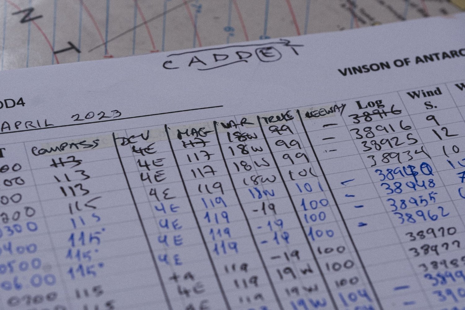
Celestial navigation begins on deck with the sextant and a watch.
When the altitude of the sun, stars, moon, or planet is taken with the exact time at Greenwich, all else happens below deck at the chart table.

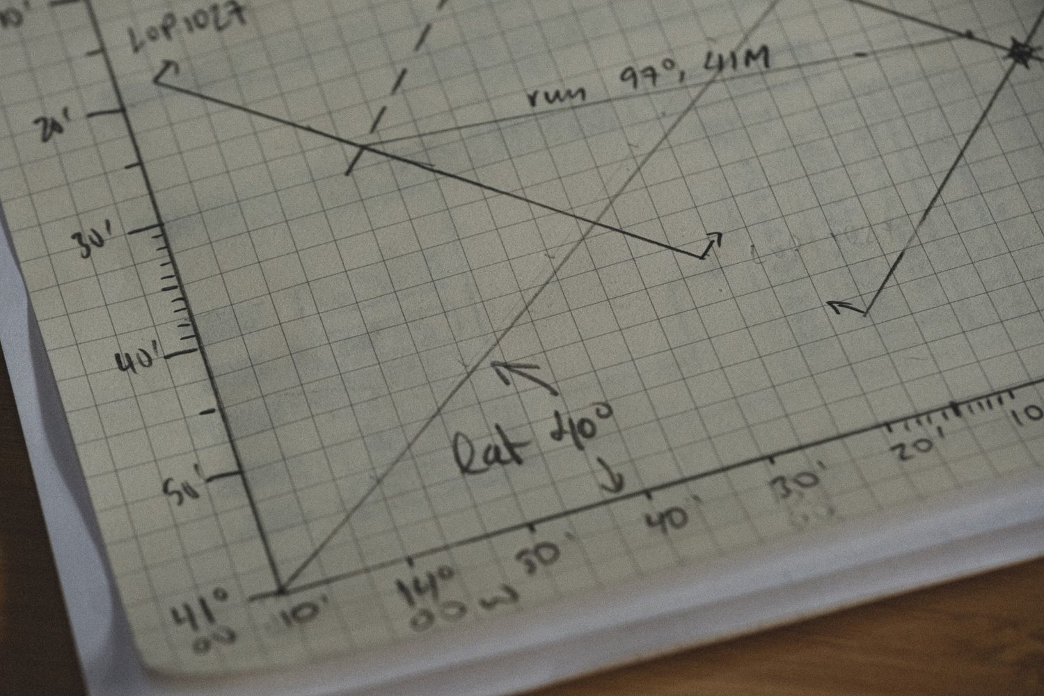
With the help of the nautical almanac and sight reduction tables, we can then plot the ‘line of position’ on the chart, which at scale is a straight line but is actually a small part of a huge circle whose center is the geographical point on earth of the celestial body.
The technique that makes it possible to draw this precise line on which our ship is located is Marq St Hilaire, after the French Captain who invented it in 1874.
For its precise plotting, a very large scale chart covering only a handful of miles is necessary, a chart that does not exist on board…
Without the luxury of the GPS, we also need to be mapmakers! We do it honouring Gerard Mercator, arguably the most significant contributor to modern navigation with his Mercator Projection.
We begin by tracing the vertical and horizontal axes of our future chart on a blank sheet of paper. We then set the latitude scale to our convenience, and by means of a sloping line that separates from the horizontal axis an angle equal to our latitude, we will end up getting a longitude scale adapted to our navigation area.
With the help of dividers, we move our latitude scale on the sloping line and then extend that new scale on the longitude axis, forming a right angle. That is all.
Unintentionally, we just faced the great dilemma of any cartographer: to represent on a plane the earth’s spherical surface.
Mercator’s Projection, depicting a portion of the spherical world, is basically a flattened version of a cylinder. His projection was designed to help sailors navigate around the globe, allowing them to lay off a straight course on a chart between their start point and destination.
On the chart we have just made, we will plot and cross the lines of position of the sun, moon, planets or stars, to obtain our daily position.
We will then transfer this valuable position to the general chart, and day by day, it will configure the route that will take our sailboat to that longed-for point in the middle of the ocean.

This is how, making charts and playing with the sun and stars, the Vinson and its crew found Gough Island – without the precision of GPS, but with the certainty and pride of good seamanship.


Pictures by Kenneth Perdigon
