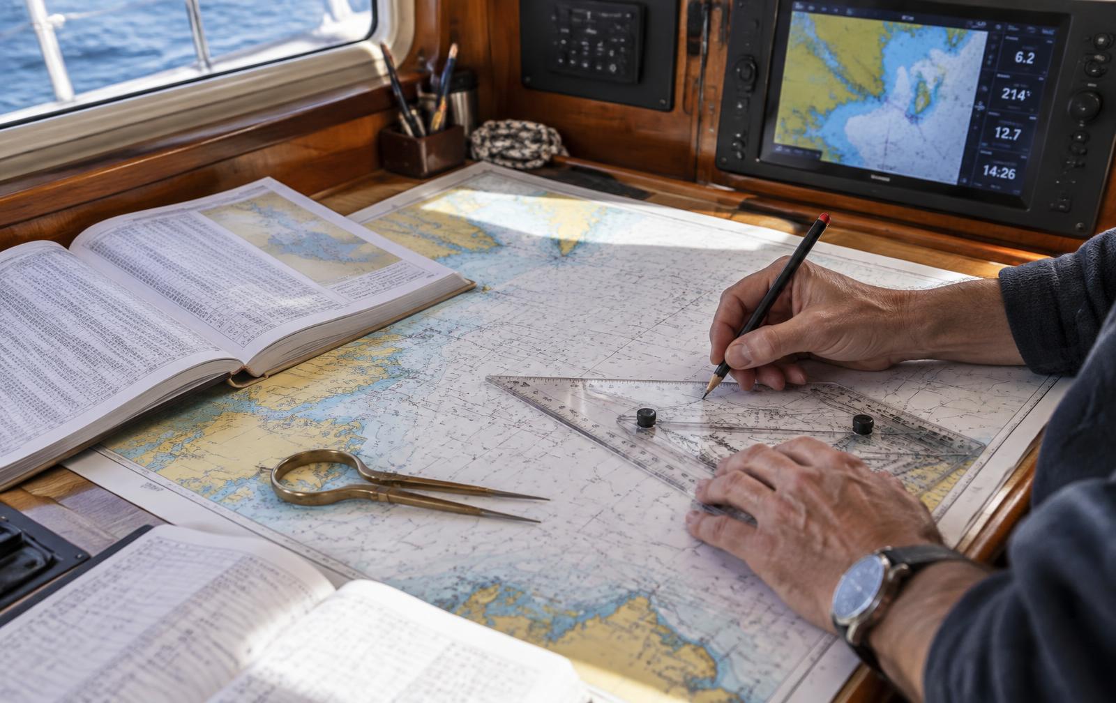
Yachtmaster Offshore Theory
Advanced chartwork, offshore passage planning, weather systems, and celestial fundamentals for the offshore skipper.
Read the guide: What is an RYA Yachtmaster qualification?Syllabus Highlights
7 sections · 7 topics · 174 outcomes
Key topics & assessment areas
Prerequisite Knowledge
Before you book
Required RYA qualifications
- RYADay Skipper Theory
Level · advanced
Where we run it
Available locations
Fornells, Menorca
Menorca
RCMB, Barcelona
Barcelona
Enrollment
Enroll on Yachtmaster Offshore Theory
Enrolling creates your course record so you can follow the syllabus, access course materials, track competencies and book practical sessions when dates suit you.
Delivered by Mt Sail & Power. Questions before you start? sail@mtsail.com
Course Content
What you'll cover
01Position fixing & advanced chartwork
3 lessonsOpenClose
Notes & self-check quiz
Position fixing & advanced chartwork
Learning objectives
- Plot and label a dead reckoning position, an estimated position and a three-bearing fix to examiner standard.
- Work a running fix from a single object and understand its error sources.
- Judge when an EP is good enough and when you need a fix.
The plotting discipline
Every position on the chart is labelled: DR with a single cross-bar, EP in a triangle, fix in a circle, each with the time. An examiner reads your chart as a record of your thinking, so the labelling matters as much as the answer.
Start from a known position, apply course steered and log distance for the DR, then apply tidal stream (set and drift) and leeway for the EP. Leeway is applied to the water track, downwind, and is estimated from the boat's behaviour — typically 0 to 10 degrees depending on sea state and sail plan.
Fixes
Three bearings, cut at good angles (ideally 60 to 120 degrees apart), taken with the fastest-changing bearing last. A small cocked hat is reassuring but not proof: a consistent compass error moves the whole triangle. Cross-check with depth, a transit or a radar range.
Common mistakes
- Applying variation and deviation the wrong way. True = Magnetic + East variation; label every bearing T or M.
- Using the log distance for a period different from the tidal hour used.
- Treating an EP as a fix when closing a hazard.
Self-check
Given a 0900 fix, course 070 M, log 6.2 knots, variation 3 W, tidal stream 130/1.8 kn and 5 degrees leeway with the wind on the port bow, plot the 1000 EP.
Quick quiz
Self-check quiz · 3 questions
1. On a chart plot, what does an EP add that a DR position does not?
2. For a reliable three-point fix, bearings should ideally be spread by roughly:
3. A running fix requires:
RYA / UKHO chart plotter (archive)
The original Admiralty RYA training plotter and training charts, for practising chartwork on a Windows PC.
RYA / UKHO chart plotter
Archive CD-ROM · Windows only
The original Admiralty RYA training plotter, with the RYA training charts used in chartwork exercises. It is a Windows program, so it installs on a PC rather than running in this browser. Install the plotter first, then unpack the charts into the same folder.
Checking your access…
Practice exercises
Practice exercises · 38
Exercise 1
- Using the corrected variation from Question 1 (rounded off to the nearest degree). Calculate the magnetic bearing for each of the following:
a) Off the coast of Maine 305°(T) b) Possession Sound 180°(T) c) Fort Lauderdale 060°(T) d) Pavlof Bay 135°(T) e) Boothbay Harbour 355°(T)
Compass Exercise, question 3
Exercise 2
- Give three causes of deviation commonly found onboard.
Compass Exercise, question 4
Exercise 3
- Convert the following compass courses to True.
Use the variation indicated and the deviation table in the training almanac.
a) Course 340°(C) Variation 10°W b) Course 070°(C) Variation 3°E c) Course 290°(C) Variation 6°W d) Course 010°(C) Variation 14°E e) Course 190°(C) Variation 12°W
Compass Exercise, question 5
Exercise 4
- Give an explanation of ‘dip’ error.
Compass Exercise, question 6
Exercise 5
- Excluding deviation, give three compass errors that you may encounter and explain how you could compensate for them.
Compass Exercise, question 7
Exercise 6
How are maritime time zones denoted, and how would a location with standard time one hour ahead of UT be designated?
Dead Reckoning and Estimated Position, question 1
Exercise 7
What is the ISO standard for denoting time zones?
Dead Reckoning and Estimated Position, question 2
Exercise 8
Express the following times in UT (all time zones are given in the maritime system or the abbreviations used within the training exercises and defined on Page 3 of the exercise booklet).
a) 1723 SP DST b) 2000 DST
Dead Reckoning and Estimated Position, question 3
Exercise 9
Using the log extract below, plot the DR at 2020 SPDST.
Date Time Log Co°(C) Wind Leeway Depth Notes Saturday, 4th May 2000 SPDST 0.0 350 SE3 00° 20m Position: 45°51.77'N 005°49.36'W 2020 SPDST 4.0 350 SE3 00° 56m Plot DR (tidal direction and rate negligible). Dead Reckoning and Estimated Position, question 4
Exercise 10
Using the log extract below, plot the estimated position at 1550 SPDST.
Date Time Log Co°(C) Wind Leeway Depth Notes Sunday, 23rd June 1450 SPDST 12.2 270 E3 00° 105m Position: 45°55.96'N 005°37.27'W 1550 SPDST 19.2 270 E3 00° 60m Estimate position using tidal [Purple diamond with letter K] Dead Reckoning and Estimated Position, question 5
Exercise 11
a) Using the log extract below, plot the estimated position at 1425 SPDST.
Date Time Log Co°(C) Wind Leeway Depth Notes Saturday, 12th October 1355 SPDST 11.4 300 W2 00° 22m Position: 45°47.41'N 005°42.53'W 1425 SPDST 17.9 300 W2 00° 20m Estimate position using tidal [Purple diamond with letter N] b) What was the vessel's COG and SOG?
Dead Reckoning and Estimated Position, question 6
Exercise 12
Using the log extract below, plot the estimated position at 1330 TZ- 0100.
Date Time Log Co°(C) Wind Leeway Depth Notes Tuesday, 26th February 1200 TZ- 0100 00.0 055 E4 5° 20m Position: 45°40.83´N 005°45.47´W 1230 TZ- 0100 02.9 055 E4 5° 60m Course change 135°(C) 1300 TZ- 0100 05.9 135 E4 5° 73m Course change 055°(C) 1330 TZ- 0100 08.6 055 E4 5° 90m Estimate position using tidal [Diamond symbol with the letter Q inside] Dead Reckoning and Estimated Position, question 7
Exercise 13
a) Using the log extract below, plot the estimated position at 1555 SPDST.
Date Time Log Co°(C) Wind Leeway Depth Notes Saturday, 12th October 1455 SPDST 00.2 090 S4 10° 5m Position: 45°53.35´N 005°46.74´W 1555 SPDST 05.6 090 S4 10° 38m Estimate position using tidal [Diamond symbol with the letter K inside] b) What was the vessel's COG and SOG?
Dead Reckoning and Estimated Position, question 8
Exercise 14
- At 0100, following a long open water passage an EP with a log reading of 110.5 is plotted at 45°37.95’N 006°21.807’W. You estimate the area of uncertainty around the EP has a radius of 5.0M.
a) List the factor that you should take into account when estimating a circle of uncertainty. b) Plot the EP and draw the circle of uncertainty. c) The echo sounder shows a depth reduced to soundings of 30m. How does this depth alter the area of uncertainty? d) A bearing of 099°(M) is plotted to Saint Stephen’s Point light. Plot the bearing and update the EP. Comment on the reliability of the fix, suggest how it could be improved.
Techniques for Visual Fixing, Question 1
Exercise 15
- A fix is plotted during the daytime for a vessel off Gordon’s Bay: The summit on Robens Island in transit with Outer Robens lighthouse. Bearing to Outer stack lighthouse 152°(M)
a) Plot the fix b) Choose another charted object and plot a third position line to enhance the fix c) How did you decide what to use for the third position line?
Techniques for Visual Fixing, Question 2
Exercise 16
- A vessel is approaching Sweetwater Bay at night. To visually monitor progress, bearings have been pre-plotted from Cape Saint Vincent light house out to the 30m contour line off the coast.
a) Starting at 085° and increasing by 10° increments plot the bearings up to 145°. b) Choose another charted feature from which bearings can be drawn in order to create a visual web of bearings. Plot a series of bearings from your chosen charted feature to enable progress towards the destination to be monitored while underway. c) Within the web there is an area where the bearings may become unreliable. Why is this? d) Rather than providing precision a pre-plotted web is more useful for providing a quick reference to a sector. For which of the following might a quick sector reference be useful? i) Navigating a fast powerboat ii) Navigating a yacht beating to windward iii) Navigating a displacement motor vessel iv) Navigating a yacht sailing with a free wind
Techniques for Visual Fixing, Question 3
Exercise 17
- A running fix is plotted from a vessel off Dymond Reef, to Token Rocks lighthouse. 1st bearing 110°(M) 2nd bearing 050°(M) Half hour run between bearings: 155°(C) 4.0M Tidal direction and rate 184°(T) 1.8kn
a) Plot the fix b) Is it necessary for the water track to be plotted from a specific point?
Techniques for Visual Fixing, Question 4
Exercise 18
- A vessel is ½ mile due south of the South Cardinal Mark off Dymond Reef. From this position a course of 235°(C) is maintained for an hour at a boat speed of 8.0kn.
a) Plot the DR position and compare it to a satellite derived position, 45°43.102´N 006°24.439´W, plotted at the same time. b) What distance is there between the DR and the satellite position? Now factor a leeway of 10°, due to a strong southerly wind, and a tidal current of 349° 2.0kn into the plot. c) Plot the EP d) What distance is there between the EP and the satellite position? e) What reason(s) could there be for the difference between the EP and the satellite position?
Techniques for Visual Fixing, Question 5
Exercise 19
Complete the following sentences: a) Parallels of... run around the world north and south of the Equator. b) Meridians of... run from pole to pole dividing the world into segments.
RYA Navigation Exercises (G7) — Question 2.1
Exercise 20
a) How many minutes are there to a degree? b) How many minutes of latitude are there to a nautical mile? c) How far is a cable?
RYA Navigation Exercises (G7) — Question 2.2
Exercise 21
When selecting charts it’s important to choose the correct scale for the intended task. Which of these scales, 1:100 000, 1:50 000, 1:25 000, would be suitable for the following? a) Planning a passage from Port Fraser to Port Fitzroy. b) Piloting out of Port Fraser. c) Piloting into Port Fitzroy.
RYA Navigation Exercises (G7) — Question 2.3
Exercise 22
a) Which type of electronic chart, Raster or Vector, enables a navigator to interrogate charted features such as buoys for additional information? b) How are electronic charts typically updated?
RYA Navigation Exercises (G7) — Question 2.4
Exercise 23
Give three examples of the information you would expect to find in a nautical almanac.
RYA Navigation Exercises (G7) — Question 2.5
Exercise 24
How are the following measured on RYA Training Charts? a) Charted depths b) Charted drying heights c) Vertical clearance d) Heights of lighthouse lights.
RYA Navigation Exercises (G7) — Question 2.6
Exercise 25
Match the following descriptions to the chart symbols: a) Wreck, depth unknown, no danger to navigation. b) Wreck showing any part at level of chart datum. c) Kelp. d) Rock awash at level of chart datum. e) Yacht harbour, marina. f) Overfalls, tide rips and races.
RYA Navigation Exercises (G7) — Question 2.7
Exercise 26
Which of the two dangerous rocks (Robinson or Cohen) lying off Cape Woodward would you expect to be visible at chart datum?
RYA Navigation Exercises (G7) — Question 2.10
Exercise 27
Convert the following TRUE bearings to MAGNETIC: a) 020°(T) variation 5°W, b) 130°(T) variation 3°E, c) 185°(T) variation 7°W, d) 000°(T) variation 6°E
RYA Navigation Exercises (G7) — Question 3.3
Exercise 28
Convert the following MAGNETIC bearings to TRUE: a) 090°(M) variation 8°E, b) 150°(M) variation 2°W, c) 225°(M) variation 5°E, d) 005°(M) variation 6°W
RYA Navigation Exercises (G7) — Question 3.4
Exercise 29
Match the descriptions below to the chartwork symbols: a) Fix, b) Water track, c) Dead reckoning, d) Waypoint, e) Ground track, f) Estimated position, g) Tidal set and drift.
RYA Navigation Exercises (G7) — Question 3.6
Exercise 30
Why would it be unwise to rely on compass readings while in position approximately two miles north of Dymond Reef?
RYA Navigation Exercises (G7) — Question 3.10
Exercise 31
Give two possible causes of compass deviation.
RYA Navigation Exercises (G7) — Question 3.11 a
Exercise 32
When is it advisable to check a compass for deviation? Give two examples.
RYA Navigation Exercises (G7) — Question 3.11 b
Exercise 33
What is heeling error?
RYA Navigation Exercises (G7) — Question 3.11 c
Exercise 34
What type of compass is commonly fitted to provide heading information for equipment such as auto-pilots and radar?
RYA Navigation Exercises (G7) — Question 3.12 a
Exercise 35
Is this type of compass (fluxgate) affected by deviation?
RYA Navigation Exercises (G7) — Question 3.12 b
Exercise 36
Under which of the following conditions would you expect to encounter the roughest seas? a) Wind blowing with the direction of the tidal stream. b) Wind blowing against the direction of the tidal stream.
RYA Navigation Exercises (G7) — Exercise 7.1
Exercise 37
What is the meaning of the term 'tidal gate'?
RYA Navigation Exercises (G7) — Exercise 7.2
Exercise 38
A navigator is planning a passage from Port Fitzroy to Victoria. Which of the following is likely to prove most convenient for obtaining an overview of the tidal streams for the passage? a) Tidal diamonds. b) Tidal stream atlas.
RYA Navigation Exercises (G7) — Exercise 7.4
Lessons (3)
- Theory & key concepts30 min
- Worked example60 min
- Self-check exercise90 min
02Tides, tidal heights & secondary ports
3 lessonsOpenClose
Notes & self-check quiz
Tides, tidal heights & secondary ports
Learning objectives
- Calculate height of tide at any time at a standard port using the tidal curve.
- Apply time and height differences to work a secondary port.
- Calculate clearance under the keel and clearance beneath an overhead cable or bridge.
The standard port curve
Enter the curve with high and low water heights and times from the almanac, draw the range line between them, then read across from your time to the height (or from the height to the time when you want a window).
Springs and neaps: interpolate between the two curves using the actual range of the day, not the calendar.
Secondary ports — worked example
Standard port HW 0912 UT, height 5.4 m; LW 1533, height 1.1 m. Secondary port differences: HW time -0025, LW time -0015, HW height -0.6 m, MHWS/MHWN interpolation applied.
- Secondary HW = 0847, height 4.8 m.
- Secondary LW = 1518, height 1.0 m. Work the curve on the secondary figures, then correct to local time before you use the answer.
Clearance
Depth of water = charted depth + height of tide. Clearance under keel = depth of water - draught. Overhead clearance uses charted vertical clearance above HAT, then add back HAT minus height of tide.
Common mistakes
- Mixing UT and local/summer time.
- Interpolating heights but forgetting to interpolate the time differences.
- Forgetting to allow for squat and swell in your safety margin.
Self-check
Charted depth 2.1 m, your draught 1.9 m, safety margin 1.0 m. What height of tide do you need, and between which times is the passage safe?
Quick quiz
Self-check quiz · 3 questions
1. Charted depth plus height of tide gives:
2. Secondary port heights are found by applying:
3. A drying height of 1.2 m means the seabed is:
Practice exercises
Practice exercises · 12
Exercise 1
What is the main cause of tides?
Vertical Datum, Depth and Heights, exercise 1
Exercise 2
During the (approximately) 28 day lunar orbit the interaction between the moon, sun and earth alters. This affects the magnitude of the tides causing spring, neap and intermediate tides. When during the lunar cycle do spring, neap and intermediate tides occur?
Vertical Datum, Depth and Heights, exercise 2
Exercise 3
The difference between successive high and low waters is known as the range of tide. Which is greater, a spring range or a neap range?
Vertical Datum, Depth and Heights, exercise 3
Exercise 4
The time at which successive high and low waters occur becomes later day by day. Why is this?
Vertical Datum, Depth and Heights, exercise 4
Exercise 5
What are the three basic tidal patterns? Give a brief description of each.
Vertical Datum, Depth and Heights, exercise 5
Exercise 6
Match the following tidal terms to the illustration below.
a) Chart Datum (CD) b) Charted depth (below CD) c) Clearance of bridge (above HAT) d) Depth of water e) Drying height f) Height of light above (above MHWS) g) Height of tide h) Highest Astronomical Tide (HAT) i) Mean High Water Neaps (MHWN) j) Mean High Water Springs (MHWS) k) Mean Low Water Neaps (MLWN) l) Mean Low Water Springs (MLWS) m) Neap range n) Spring range
[A cross-section diagram of a coastline showing a lighthouse, a bridge, and a boat. Various vertical measurements are labeled with Roman numerals (i) through (xiv). The diagram includes levels for the seabed, drying banks, chart datum, and various tidal heights up to a bridge and lighthouse.]
Vertical Datum, Depth and Heights, exercise 6
Exercise 7
Tide tables give the times and heights of high and low water for different ports. The times, which are presented in local zone time, may need to be adjusted if Daylight Saving Time (DST) is being kept during summer. Find the times and heights of high and low water at the following places; adjust for DST if required. Note whether the range is at: mean spring, mean neap or an intermediate point.
a) Victoria In the afternoon / evening of Thursday, 3rd January. b) Victoria In the afternoon / evening of Tuesday, 15th October. c) Victoria In the afternoon / evening of Monday, 25th November. d) Namley Harbour Mid morning to mid afternoon on Wednesday, 24th April. e) Namley Harbour On the morning of Thursday, 5th December f) Namley Harbour On the morning of Sunday, 18th August. g) Colville In the afternoon / evening of Sunday, 28th April h) Colville In the afternoon / evening of Saturday, 23rd November. i) Colville On the morning of Sunday, 4th August.
Vertical Datum, Depth and Heights, exercise 7
Exercise 8
A tidal curve can be used to find the height of tide between high and low water. Using the appropriate tidal curve find the height of the tide at the following places and note whether the tide is rising or falling.
a) Victoria on Thursday, 3rd January at 1600 UT b) Namley on Sunday, 18th August at 0600 DST c) Colville on Saturday, 23rd November at 1710 Zone -1
Vertical Datum, Depth and Heights, exercise 8
Exercise 9
Once the height of the tide has been found for a given place and time it can be applied to the chart's datum. This enables navigators to make various essential calculations, for example: predicting what clearance there's likely to be under a moored vessel at low water. Calculating what clearance a vessel is likely to have when using a small craft channel or swashway. Working out the duration of a 'safe clearance' period at the shallow entrance of a harbour.
a) Place: Victoria Date: Saturday, 21st September Time: 1340 DST If a vessel is moored at Victoria in a depth of water of 6.0m at 1340 DST, what will the depth of water at the mooring be at the next low water?
b) Place: Port Fraser Date: Wednesday, 11th September Time: 13:30 DST What clearance will a vessel (draught 1.8m) have as it crosses the 'least depth' area of 0.7m in the Inner Swashway near the entrance to Port Fraser?
c) Place: Namley Harbour Date: Thursday, 24th October Time: 1140 DST At 1140 DST a vessel leaving Namley Harbour passes the tide gauge at the entrance, which shows 2.6m (on the rising tide).
At what time will the vessel need to return to have the same height of tide as it passes the tide gauge again (on the falling tide)?
d) Place: Colville Date: Tuesday 19th November Time: 0800 Zone - 1 What depth of water will there be in Colville Marina (charted depth 3.1m) at 0800 Z - 1 on Tuesday 19th November?
e) Place: Hamilton Sound Date Friday 12th July Time: 1700 SPDST What depth would be found along the 20m contour off Hamilton Sound at 1700 SPDST on Friday 12th July?
f) Place: Port Fitzroy Date Thursday 12th September Time: 2045 SPDST Will Tower Rock (45°39.695´N 005°46.706´W) be covered or uncovered at 2045 SPDST?
Vertical Datum, Depth and Heights, exercise 9
Exercise 10
Secondary ports although local tide tables may be available for (smaller) secondary ports; almanacs tend to use a system that applies differences to a standard port’s tidal information to arrive at the times and heights for a secondary port. Using the appropriate differences, answer the following secondary port tidal height questions:
a) Place: Endal Marina Date: Saturday, 2nd February Time: 1700 UT What will the height of tide be at Endal Marina on Saturday, 2nd February at 1700 UT? What will the depth of water be over the sill at the entrance to Endal Marina at this time on Saturday, 2nd February?
b) Place: Farlow Date: Friday, 30th August Time: 1340 DST What will the height of tide be at Farlow on Friday, 30th August at 1340 DST? i) What clearance will there be under the rail bridge at this time on Friday, 30th August? ii) What depth of water will there be off the Upper Town Quay at the same time?
c) Place: Parvin Sound Date: Tuesday, 16th July Time: 1800 DST What will the height of tide be at Parvin Sound on Tuesday, 16th July at 1800 DST? At this time on Tuesday, 16th July the crew of a vessel, draught 1.3, are preparing to anchor in Parvin Sound. In what depth of water should the vessel be anchored to ensure a clearance of 2.0m below the keel at the next low water?
d) Place: Port Slade Date: Thursday, 23rd May Time: 1240 SPDST What will the height of tide be at Port Slade on Thursday, 23rd May at 1240 SPDST? At this time on Thursday, 23rd May a vessel approaching Port Slade runs aground on the falling tide. At what time on the rising tide will the vessel re-float?
e) Place: Suzy Bay Marina Date: Wednesday, 26th June Time: 1100 DST What will the height of tide be at Suzy Bay Marina on Wednesday, 26th June at 1100 DST? What will be the depth of water at the shallowest spot (1.2m) between Little Ryes island and the mainland at this time on Wednesday, 26th June? Use the differences for Suzy Bay Marina.
f) Place: Stevenstown Date: Monday, 22nd July Time: 1320 DST What will the height of tide be at Stevenstown on Monday, 22nd July at 1320 DST? If a vessel picked up a mooring off Stevenstown at this time when the depth of water was 5.0m, what would the depth of water be at the next low water?
Vertical Datum, Depth and Heights, exercise 10
Exercise 11
Which of the following indicates the approach of spring tides? a) A full moon, b) A half moon, c) A new moon
RYA Navigation Exercises (G7) — QUESTION 8.2
Exercise 12
Which of the following would be most likely to cause a lower than predicted tidal height? a) High barometric pressure, b) Strong, prolonged winds blowing into an estuary, c) Low barometric pressure
RYA Navigation Exercises (G7) — QUESTION 8.3
Lessons (3)
- Theory & key concepts30 min
- Worked example60 min
- Self-check exercise90 min
03Tidal streams & course to steer
3 lessonsOpenClose
Notes & self-check quiz
Tidal streams & course to steer
Learning objectives
- Extract stream rates from tidal diamonds and atlases, interpolated for the day's range.
- Construct a course to steer for one hour and for a multi-hour passage.
- Calculate speed over ground and estimated time of arrival.
Building the vector triangle
- From your start position, plot the ground track you want (the line to the destination).
- From the same point, plot the tidal vector for one hour: direction the stream sets towards, length equal to its rate.
- From the end of the tidal vector, swing an arc equal to your boat speed through the water to cut the ground track.
- The arc line is the water track — that is your course to steer. Correct for leeway, then for variation and deviation to get a compass course.
- Distance from origin to the intersection is your speed over ground.
Multi-hour passages
For a passage of three hours, plot three consecutive hourly tidal vectors end to end, and swing an arc of three times your boat speed. This gives one steady course to steer for the whole leg — more efficient than re-steering each hour.
Common mistakes
- Using stream from instead of sets towards.
- Interpolating for springs and neaps incorrectly; the atlas figures are for mean springs and mean neaps.
- Forgetting that the intersection gives SOG, not boat speed.
Self-check
Ground track 245 T, distance 14 NM, boat speed 6 kn, tide hour 1 190/2.1 kn, hour 2 205/1.6 kn. Find the course to steer and the ETA.
Quick quiz
Self-check quiz · 3 questions
1. In the course-to-steer triangle, the tidal vector is drawn:
2. The intersection of boat-speed arc and ground track gives:
3. Leeway is applied:
Practice exercises
Practice exercises · 10
Exercise 1
At 1055 SPDST on Tuesday, 28th May a vessel is in position 45°59.70´N 005°54.56´W. The vessel’s destination is 45°51.77´N 005°49.36´W.
a) What is the magnetic course to steer to the destination? b) How long will it take to reach the destination?
Use [Diamond J] for tidal direction and rate information. Boat speed 6.5kn. No leeway.
Course to Steer, question 1
Exercise 2
At 1845 SPDST on Wednesday, 1st May a vessel is in position 45°59.85´N 005°56.66´W. The vessel’s destination is 45°59.01´N 006°07.65´W.
a) What is the magnetic course to steer to the destination? b) How long will it take to reach the destination?
Use [Diamond J] for tidal direction and rate information. Boat speed 6.0kn. Apply 5° leeway due to a southerly wind.
Course to Steer, question 2
Exercise 3
At 0230 TZ - 0100 on Saturday, 30th March a vessel is in position 45°54.70´N 005°55.43´W. The vessel’s destination is 45°55.26´N 006°04.19´W.
a) What is the compass course to steer to the destination? b) How long will it take to reach the destination?
Use the Tidal Stream Atlas for tidal direction and rate information. Boat speed 6.0kn. Apply 10° leeway due to a northerly wind.
Course to Steer, question 3
Exercise 4
At 0544 SPDST on Wednesday, 18th September a vessel is in position 45°50.56´N 005°48.87´W. The vessel’s destination is 45°46.93´N 005°57.24´W.
a) What is the compass course to steer to the destination? b) How long will it take to reach the destination?
Use [Diamond N] for the first 1/2 hour, then [Diamond P], for tidal direction and rate information. Boat speed 7.5kn. Apply 5° leeway due to a northerly wind.
Course to Steer, question 4
Exercise 5
At 1631 TZ - 0100 on Thursday, 3rd January a vessel is in position 45°48.95´N 006°00.23´W. The vessel’s destination is 45°54.21´N 005°53.92´W.
a) What is the compass course to steer to the destination? b) How long will it take to reach the destination?
Use tidal [A pink diamond containing the letter L] for tidal direction and rate information. Boat speed 12.0kn.
Apply 5° leeway due to a northerly wind.
Course to Steer, question 5
Exercise 6
At 2125 SPDST on Tuesday, 22nd October a vessel entering the Traffic Separation Scheme is in position 46°04.46´N 005°55.32´W. In order to cross the traffic flow at right angles the helmsman is asked to hold a course of 188°(C).
a) Draw a projected EP to estimate where the vessel will exit the TSS, give latitude and longitude. b) What is the estimated COG and SOG? c) How long will it take for the vessel to cross the TSS?
Use tidal [A pink diamond containing the letter J] for tidal direction and rate information. Boat speed 8.0kn.
Course to Steer, question 6
Exercise 7
1 It's not uncommon for observations of currents/tidal streams (made in the vicinity of buoys, beacons etc) to be different to the tabulated information found in sailing directions and almanacs.
a) Would you expect observations of the current/tidal stream in Farlow Channel made in the vicinity of lateral buoys FC1 (46°11.10´N 005°41.15´W) and FC2 (46°11.10´N 005°45.00´) to be the same as the tabulated information given for tidal [a magenta tidal diamond with the letter C inside] (46°11.20´N 005°43.20´.4W). Give the reason for your answer.
b) If a difference between the current/tidal stream found at the buoys and that at the position of the diamond was observed; where would you expect the current to be weaker, close to the buoys or at the diamond's position? Give the reason for your answer.
Tidal Streams, Question 1
Exercise 8
- At what time during the afternoon of Friday, 6th December does the current start to ebb out of Namley Harbour? Use the tidal stream atlas.
Tidal Streams, Question 2
Exercise 9
- Use the tidal diamonds on Chart 3 to find the direction and rate of the current at the following positions:
i) Diamond A (46°20.5´N 005°50.0´W) on Tuesday, 28th May 0955 - 1055 DST ii) Diamond C (46°11.2´N 005°43.2´W) on Wednesday, 2nd October 1111 - 1211 DST iii) Diamond E (46°10.5´N 006°16.1´W) on Saturday, 8th June 1201 - 1301 DST iv) Diamond H (46°02.1´N 006°17.8´W) on Sunday, 28th April 1526 - 1626 DST v) Diamond K (45°56.0´N 005°42.2´W) on Wednesday, 23rd January 0935 - 1035 UT
Tidal Streams, Question 3
Exercise 10
- Use the tidal stream atlas in the almanac to find the overall set and drift due to tidal stream influence during the time periods shown for the following locations:
i) Farlow Channel (46°11.20´N 005°43.20´W) on Tuesday, 26th February 1300 - 1340 UT ii) Off West Point Ledge (46°20.60´N 006°18.40´W) on Friday, 8th March 1715 - 1755 UT iii) Neptune Channel (45°48.20´N 005°45.30´W) on Sunday, 31st March 1430 - 1600 DST iv) Off Hamilton (45°39.60´N 006°18.00´W) on Sunday, 1st September 1505 - 1645 DST
Tidal Streams, Question 4
Lessons (3)
- Theory & key concepts30 min
- Worked example60 min
- Self-check exercise90 min
04Tides interactive (archive)
0 lessonsOpenClose
All 15 interactive tides screens from the restored Shorebase courseware, with full narration — causes of tides, chart datum, rule of twelfths, tidal curves, secondary ports and tidal streams.
Notes & self-check quiz
Causes of tides
Causes of tides 1
Tides are the vertical rise and fall of the surface of a body of water, caused primarily by the gravitational attraction of the moon and to a lesser extent, the sun. The rotation of the earth is the primary cause of two high tides and two low tides per day, also called semidiurnal tide, experienced in most parts of the world. Some locations on earth have only one high tide and one low tide per day - called diurnal tide - due to the path of the moon and other geographical factors. A few other places experience a combination of diurnal and semidiurnal tides, called mixed tides. The difference in height between a high tide going to a low tide, or a low tide going to a high tide is called the tidal range. The rising tide is called the flood tide and the falling tide is called the ebb tide.
Causes of tides 2
Spring tides are those with higher high tides and lower low tides than normal, or a greater range of tide. They occur when the sun and the new moon, or the sun and the full moon are in straight line with the earth exerting a larger than normal gravitational force, and therefore causing a greater than usual tidal range. Neap tides are tides with lower high tides and higher low tides than normal - in other words - a smaller range of tide. These occur when the moon is in a quarter phase and the sun, moon and earth form a right triangle. Because the sun is not in a straight line with the earth, the gravitational pull of the sun counteracts the gravitational pull of the moon and as a result, the tidal range is unusually small.
Tide heights and chart datum
Tide heights chart datum 1
Let’s have a closer look at "Tidal Heights" and "Chart Datum". On nautical charts, soundings and drying heights are measured from Chart Datum. Chart Datum is the Lowest Astronomical Tide or L A T , meaning the lowest level to which the tide is expected to fall. All depths on a chart are measured below chart datum and all drying heights are measured above it. Non-drying heights, for example a lighthouse, are always measured above Mean High Water Springs, not Chart Datum, as an added safety margin. The height of tide is always measured above Chart Datum.
Tide heights chart datum 2
The difference of height between Mean High Water Spring (MHWS) and Mean Low Water Spring (MLWS) is referred to as spring range. Also, the difference in height between Mean High Water Neap and Mean Low Water Neap is referred to as neap range.
Rule of twelfths
Rule of twelfths 1
There are two methods of calculating the tidal height. The first uses the tide tables, which is a very accurate method, and the second uses the "Rule of Twelfths", which is not so accurate and should be used with caution! To use the "Rule of Twelfths," we assume that the tide rises and falls in the same pattern. A six-hour tide is expected to rise or fall in the 1st hour 1/12 of its range. In the 2nd hour 2/12 of its range. In the 3rd and the 4th 3/12 of its range. In the fifth hour 2/12 of its range and in the 6th hour 1/12 of its range.
Rule of twelfths 2
To find the times, heights and range of the tide it is necessary to consult the tide tables. Let’s use the "Rule of Twelfths" for the port of Portsmouth on the 1st of November. The first high water is at 00:45 UTC and the height of tide is 4.0 meters. The next low water will be at 05:52 with a height of tide of 0.5 meters. Now we calculate the range by subtracting the high water from the low water. In our case 4.0 meters minus 0.5 meters equals 3.5 meters. Dividing the range by 12 gives us a unit for our calculation - 3.5 meters divided by 12 equals 0.33 meters.
Rule of twelfths 3
To calculate the fall of the tide for 02:45 UTC we now use the "Rule of Twelfths". First we have to calculate the time. 02:45 UTC minus 00:45 UTC gives us 2 hours. As we already know, in the first hour the tide will fall 1/12 of its range, which is 0.33 meters. For the second hour the tide will fall 2/12 of its range, which is 0.66 meters. The total fall for the tide in two hours is 0.33 plus 0.66 meters, which equals 0.99 meters. Now we can calculate the height of the tide for 02:45 UTC. Height of the tide for 02:45 UTC is 4.0 meters minus the fall of the tide - 0.99 meters - equaling 3.01 meters. The final step is to add the height of the tide to the charted depth on the chart.
Tides for a standard port
Tides for standard port 1
Let’s now use the tide table to calculate the tide for a standard port. But first, what is a standard port? In the tide table we distinguish between standard ports and secondary ports. A standard port is a port for which the times and heights of high and low water are predicted for every day of the year. A secondary port is a port that has an assigned standard port. The reason for the use of secondary ports is that it is impossible to list the times of high and low of each port in the world. The tidal curves of the secondary port and the assigned standard port are assumed to be the same.
Tides for standard port 2
Here is an excerpt of a Tide Table. In the first line you see the name of the standard port and where it is located. In the second line information is provided about the time zone in which the times of high and low water are calculated and the coordinates of Portsmouth. In the third line you find the month and the year from which times and tides are calculated. On the left side the day of the month. On the right side you will find times and heights of the tide.
Tides for standard port 3
Let’s now find out the times and heights of high and low water on September 1st. Note that all times are in UTC (Coordinated Universal Time), formerly known as GMT (Greenwich Mean Time). Watch out - if you are on British Summer Time, you have to add one hour to UTC. On September 1st high water is at 09:56 and 21:30, and low water is at 02:50 and 14:30. Now, if you want to know the actual depth of water in Portsmouth at 14:30, you just have to add the charted depth of Portsmouth and the low water. Low water at 14:30 is 0.4 meters and the charted depth is 6 meters. We add 0.4 meters and 6.0 meters, so the actual depth in the harbor of Portsmouth is 6.4 meters. In case the height of low water is minus, you have to subtract instead of add.
The tidal curve
The tidal curve 1
The Tidal Curve is another method of determining times of high and low water. Before you use the curve, note the times and heights of tide for the day from the tide table. Let’s again use Portsmouth on September 1st. First you have to enter the time of the day nearest high water - if it is now 09:45 then we take the next high water at 9:56. Now we mark the low water on the lower scale and the high water on the upper scale, and connect both values with a straight line.
The tidal curve 2
If you need the height of the tide for a particular time, for example for 13:00, just enter the required time at the timescale grid. 13:00 is roughly 3 hours after high tide. Then check whether the tidal range is close to a spring range or neap range. In our case we have a tidal range of 3.8 meters; 4.2 - 0.4 equals 3.8 meters. As we can see from the mean ranges, 3.8 meters is close to a spring range. Next we draw a line from 3 hours after high water to the spring curve. Here we can interpolate by eye. From the intersection of the line and the spring curve we draw a horizontal line to the high and low water line. From here we draw a line to join the top scale. The number at this point is the height above chart datum of the tide at the required time. To calculate the total depth of water in the Port of Portsmouth, we add the height of tide to the depth shown on the chart.
Corrections for a secondary port
Corrections for secondary port 1
Now let’s see how we calculate the times of high and low water in a secondary port. Let’s take Barfleur. First we have to look up which standard port is assigned to Barfleur, and we find it is Cherbourg. For Barfleur we want to obtain the time of high water in the evening. So first we look up the time of high water in Cherbourg. As we can see from the table, high water is at 18:46 and the height of the tide is 5.6 meters. We make a note of these figures.
Corrections for secondary port 2
Now we take the table for the secondary port, Barfleur. At the top we have the times of high and low water, and the time differences. To the right we have the heights of high and low water, and the height differences. Let’s first calculate the time difference. 18:46 lies a little over half the interval between 15:00 and 21:00. Now we have to interpolate between 51 minutes and 44 minutes. The time difference for high water should then read 47 minutes. Then we add the minutes to 18:46 to equal 19:33. The high water in Barfleur will be at 19:33.
Corrections for secondary port 3
We calculate the height of the tide in the same manner. 5.6 meters lies at about half the interval between plus 0.3 and plus 0.9 meters. So the height difference for high water should read plus 0.6 meters. We apply this figure to the high water in Cherbourg. 5.6 meters plus 0.6 meters equals 6.2 meters. The high water in Barfleur at 19:33 will be 6.2 meters.
05Electronic navigation: GNSS, plotters & radar
3 lessonsOpenClose
Notes & self-check quiz
Electronic navigation: GNSS, plotters & radar
Learning objectives
- Understand what GNSS actually gives you, and how it fails.
- Configure a chart plotter sensibly and cross-check it against paper.
- Interpret a radar picture for collision avoidance and pilotage.
GNSS
Position accuracy is typically a few metres, but accuracy is not the same as reliability. Datum mismatch, chart survey age, jamming and spoofing all put you somewhere other than where the screen says. The chart is often the weakest link: many surveys predate satellite positioning.
Plotter setup
Set safety depth and shallow contour for your draught, turn on the guard zone, choose a sensible chart detail level, and check the datum matches your paper chart. Know how to drop a waypoint, start a route and read XTE at speed.
Radar
Radar gives range and bearing, and range is far more accurate than bearing. Use range rings and VRM/EBL for a target's closest point of approach: a target whose bearing does not change and whose range is decreasing is on a collision course. Learn the picture in clear weather so you can read it in fog.
Common mistakes
- Navigating by the plotter alone with no independent cross-check.
- Believing radar bearings to the same precision as ranges.
- Missing the difference between COG/SOG and heading/log speed.
Self-check
Your plotter shows COG 090 and SOG 5.8 kn; your compass reads 076 and the log 6.4 kn. What is happening, and what will you plot?
Quick quiz
Self-check quiz · 3 questions
1. COG and SOG from a GPS differ from heading and log because of:
2. Radar EBL and VRM are used to measure:
3. Good practice with a chart plotter is to:
Practice exercises
Practice exercises · 30
Exercise 1
You are planning a route on a paper chart and intend to use a GNSS receiver, which does not have a chart plotter facility, as an aid to navigation.
a) Why would you avoid placing waypoints directly on navigational aids or features? b) When transferring the waypoint positions from the paper chart to the GNSS there is potential for error. What steps should you take to reduce this?Electronic Aids to Navigation, question 1
Exercise 2
A vessel navigating in the vicinity of Strongholm Island has 46°21'.03N 5°44'.12W as a GPS waypoint. At 1330 local time the range is given as 3.95nm, and the bearing as 070° (T).
a) Plot the fix. b) How could this be independently verified?Electronic Aids to Navigation, question 2
Exercise 3
Use RYA Training Electronic Chart Plotter and RYA Training Chart 4.
a) What is the quality of data zone in November Bay? b) How much reliance should be placed on the soundings in November Bay? c) Look at Chart 4 when did the survey take place and how was it carried out in November Bay? d) What are the practical implications of your answers to the above three questions? e) Having answered a) to d) above; what additional information could aid you in deciding whether to enter November Bay at night? f) What pilotage techniques could you use to enter November Bay at night? Considering these techniques would you be comfortable making this entry on a 35ft boat, with a draft of 1.6m?Electronic Aids to Navigation, question 3
Exercise 4
Which is potentially more dangerous, a log that over-reads or one that under-reads? Give reasons.
Electronic Aids to Navigation, question 4
Exercise 5
When siting a GPS aerial on a vessel should it be placed: a) As low as practicable? b) As high as practicable? Give the reason for your choice.
Electronic Aids to Navigation, question 5
Exercise 6
When using Radar as a pilotage aid, why might it be difficult to identify a narrow harbour entrance from a distance.
Electronic Aids to Navigation, question 6
Exercise 7
When using Radar for navigation, would you place more emphasis on range or bearings? Why?
Electronic Aids to Navigation, question 7
Exercise 8
What are each of the following:
a) ENC b) RNC c) Electronic Chart d) ECDIS e) RADAR f) MARPA g) AISElectronic Aids to Navigation, question 8
Exercise 9
Why is it important for a navigator to practice using aids such as Radar and electronic navigation systems in clear weather and good visibility?
Electronic Aids to Navigation, question 9
Exercise 10
How does a GNSS system attain a fix of its position?
Electronic Aids to Navigation, question 10
Exercise 11
How would you check the accuracy of your echo sounder? Name two methods.
Electronic Aids to Navigation, question 11
Exercise 12
What external factors could affect the reading from an echo sounder? List two.
Electronic Aids to Navigation, question 12
Exercise 13
When testing and setting up an echo sounder, what are the advantages and disadvantages of calibrating the reading to:
a) The waterline. b) The bottom of the keel/point of maximum draft. c) The transducer (no offset).Electronic Aids to Navigation, question 13
Exercise 14
A GNSS receiver displays an HDOP reading of 9.
a) Does this indicate a high or low level of precision in the displayed position? b) How could a navigator quickly identify inaccuracies in GNSS derived positions?Electronic Aids to Navigation, question 14
Exercise 15
In 2016 a skipper is planning a route from Beaker Bay to Victoria.
- Import the overlay 'Beaker Bay to Victoria' to show the planned route and then go to the start of the route in Beaker Bay, Synka.
a) Mark the area off Quay Ness between the 10m and 20m contour lines in yellow as a hazard. Name this area 'Off Quay Ness'. b) Mark the overfalls off Huckle Head in red as a danger area. c) Along the route, identify two further areas that could benefit from similar highlighting, and explain the reasons for your choice.
Electronic Chart Plotting, question 1
Exercise 16
- To aid monitoring of the route between Synka Fairway precautionary area WPT and Synka Fairway End WPT the skipper plans to use clearing bearings taken from the lighthouse on Leslie Head.
a) Create a clearing bearing from Leslie Head lighthouse through Synka Fairway Precautionary Area WPT and extending beyond the Huckle Head overfalls up to the west of the Synka Fairway End WPT. b) What Magnetic bearing would this be? Use 2016 as the year. c) To ensure the vessel remains to the East of Huckle Head overfalls, would the bearing need to be greater or less than the answer given 12b. d) Create a second back bearing from the Leslie Head lighthouse to show a western limit suitable for avoiding the precautionary area and shipping lanes. e) Mark the area inside the two bearings as a navigable area in green, from the Synka Fairway precautionary area WPT to just past the Synka Fairway End WPT. f) Describe how you would use the two bearings to ensure you stay in the green area.
Electronic Chart Plotting, question 2
Exercise 17
- Using the Route Monitor, open each of the NMEA files listed below. Comment on the navigational situation in terms of GNSS reliability, your progress compared to your plan and any action you may take as a result of this information.
NB: Once you have opened the Route Monitor and clicked to play a scenario you will need to open the file relating to each question (numbered accordingly) these should have been downloaded at the beginning of this section however if not, they can be found at: www.rya.gov.uk/go/training.
a) File: YM_ENA2016_Q13a_Simulation or video for Q3a I. HDOP II. XTE III. Number of satellites IV. Quality of position V. Action by skipper
b) File: YM_ENA2016_Q13b_Simulation or video for Q3b I. HDOP II. XTE III. Number of satellites IV. Quality of position V. Action by skipper
c) File: YM_ENA2016_Q13c_Simulation or video for Q3c I. HDOP II. XTE III. Number of satellites IV. Quality of position V. Action by skipper
Electronic Chart Plotting, question 3
Exercise 18
- Under SOLAS chapter V, what should be fitted to all vessels (where practicable), regardless of size, in order to improve your visibility to other craft?
International Maritime, Q6
Exercise 19
Why might an echo sounder fail to give reliable depth readings when in the vicinity of the wash from a large vessel such as a ferry?
RYA Navigation Exercises (G7) — Question 11.1
Exercise 20
a) Which of the following would you expect a basic through-hull log to supply? i) Speed through the water. ii) Speed over the ground. iii) Both.
b) Which is potentially more dangerous: a log which over-reads or one that under-reads? Give reasons.
RYA Navigation Exercises (G7) — Question 11.2
Exercise 21
What advice would you give a newcomer to navigation with regard to best practice (regarding GPS)? List four.
RYA Navigation Exercises (G7) — Question 11.3
Exercise 22
What do the following abbreviations commonly displayed on GPS screens stand for? a) COG b) SOG c) DTW d) BTW e) XTE f) ETA
RYA Navigation Exercises (G7) — Question 11.4
Exercise 23
The display on your GPS receiver shows an HDoP of 1.4, a few minutes later this increases to 3.2. a) To what does the HDoP number refer? b) Which is the more favourable number?
RYA Navigation Exercises (G7) — Question 11.5
Exercise 24
Which of the following is a preferable position to site a GPS aerial? a) Inside a cockpit locker to avoid it getting wet b) High up, on the top of a mast c) Low down, clear of obstructions
RYA Navigation Exercises (G7) — Question 11.6
Exercise 25
Which of the following would be the safest course of action when crossing a channel such as the Neptune Channel in strong cross tide? a) Following a changing GPS bearing to a waypoint. b) Working out a course to steer allowing for the tidal stream and monitoring the course using XTE.
RYA Navigation Exercises (G7) — Question 11.7
Exercise 26
What precautionary checks should be made before relying on a GPS route for navigation?
RYA Navigation Exercises (G7) — Question 11.8
Exercise 27
What sort of electronic chart plotter is likely to be most suitable for installation on board an open boat such as a RIB? a) A dedicated chart plotter with built in GPS receiver. b) A laptop with chart-plotting software connected to a GPS receiver.
RYA Navigation Exercises (G7) — Question 11.9
Exercise 28
Why is it inadvisable to navigate using an electronic chart that has been magnified beyond the scale to which it was originally produced?
RYA Navigation Exercises (G7) — Question 11.10
Exercise 29
To which type of electronic chart, Raster or Vector, do the following apply? a) The chart can be interrogated to reveal extra information about a selected feature. b) The chart is an electronic copy of its paper equivalent. c) Information on the chart is grouped in layers, which can be selected or de-selected. d) The level of detail on the chart changes when zooming in or out.
RYA Navigation Exercises (G7) — Question 11.11
Exercise 30
a) What is the significance of a radar target which remains on a steady bearing while progressing towards the centre of the screen? b) How would the signal from a SART be displayed on a radar screen?
RYA Navigation Exercises (G7) — Question 11.12
Lessons (3)
- Theory & key concepts
- Worked example
- Self-check exercise
06Collision regulations in depth
3 lessonsOpenClose
Notes & self-check quiz
Collision regulations in depth
Learning objectives
- Apply the steering and sailing rules from memory, including in restricted visibility.
- Identify stand-on and give-way vessels in any encounter and take proper action.
- Understand traffic separation schemes and narrow channels.
The framework
Rule 5 lookout, Rule 6 safe speed and Rule 7 risk of collision underpin everything. If the compass bearing of an approaching vessel does not appreciably change, risk of collision exists.
Rule 8: action must be positive, made in ample time, and obvious to the other vessel — a large alteration of course is better than a series of small ones. Rule 17 gives the stand-on vessel the right, and eventually the duty, to act.
Rule 12 between sailing vessels: opposite tacks, port gives way; same tack, windward gives way; if in doubt with a vessel to windward on an undetermined tack, give way.
Rule 19 in restricted visibility abolishes stand-on: both vessels take action. Avoid altering to port for a vessel forward of the beam, and avoid altering towards a vessel abeam or abaft the beam.
Narrow channels and TSS
Rule 9: keep to the starboard side, do not impede vessels that can only navigate within the channel. Rule 10: join and leave at the ends where practicable, cross on a heading as nearly as practicable at right angles to the traffic flow.
Self-check
You are close-hauled on starboard at night and see a green light fine on the port bow with a steady bearing. What do you do, and which rules apply?
Quick quiz
Self-check quiz · 3 questions
1. A steady compass bearing with decreasing range means:
2. Two power-driven vessels meeting head-on should:
3. An action to avoid collision should be:
Practice exercises
Practice exercises · 48
Exercise 1
- A power driven vessel is deemed to be the stand-on vessel. What action should it take, and/or consider, in complying with the collision regulations?
IRPCS, Q3
Exercise 2
- In the following situations a risk of collision exists. Explain which vessel(s) should give-way. Why should they give-way? What action they should take?
a) [Diagram showing two sailing vessels. Vessel A is to windward of Vessel B. Wind is blowing from left to right. Both vessels are on a starboard tack.] b) [Diagram showing two power-driven vessels. Vessel A is on the port side of Vessel B and their paths cross.] c) [Diagram showing two sailing vessels. Vessel A is on a port tack. Vessel B is on a starboard tack. Wind is blowing from top to bottom.] d) [Diagram showing two power-driven vessels meeting head-on.]
IRPCS, Q4
Exercise 3
- How might you establish if there is a risk of collision when in sight of an approaching vessel?
IRPCS, Q7
Exercise 4
- How might you tell if a risk of collision exists when not in sight of an approaching vessel?
IRPCS, Q8
Exercise 5
- If you are in any doubt as to whether a risk of collision exists, what should you do?
IRPCS, Q9
Exercise 6
- When taking action as give-way vessel, how should any alteration be executed?
IRPCS, Q10
Exercise 7
- What can produce a blind arc on a vessel? List three reasons.
IRPCS, Q11
Exercise 8
- Having identified likely blind arcs on board a vessel, suggest a step you could take to ensure you can effectively assess a risk of collision?
IRPCS, Q12
Exercise 9
- What is the difference between 'shall' and 'may' for the purposes of IRPCS?
IRPCS, Q13
Exercise 10
- Suggest two factors you would take into consideration when determining a safe speed?
IRPCS, Q14
Exercise 11
- Under what circumstances, if any, is it permissible to make a departure from the IRPCS?
IRPCS, Q17
Exercise 12
What do the Rules (Collision Regulations) say about keeping a look-out?
RYA Navigation Exercises (G7) — Exercise 4.1a
Exercise 13
Where should the crew of a sailing vessel expect to encounter blind spots when keeping a look-out?
RYA Navigation Exercises (G7) — Exercise 4.1b
Exercise 14
What do the Rules say about the 'right of way' of vessels at sea?
RYA Navigation Exercises (G7) — Exercise 4.1c
Exercise 15
List factors that should be considered when determining a safe speed.
RYA Navigation Exercises (G7) — Exercise 4.2
Exercise 16
How can you tell if a risk of collision exists when in sight of an approaching vessel?
RYA Navigation Exercises (G7) — Exercise 4.3
Exercise 17
You are in a situation where a risk of collision exists and you are required by the Rules to give way to the other vessel. At what stage should you take avoiding action?
RYA Navigation Exercises (G7) — Exercise 4.4a
Exercise 18
You are in a situation where a risk of collision exists and you are required by the Rules to give way. At night, how can you help to ensure the action you take is immediately obvious to the crew of the other vessel?
RYA Navigation Exercises (G7) — Exercise 4.4b
Exercise 19
What is the meaning of the following day shape: A black cylinder?
RYA Navigation Exercises (G7) — Exercise 4.5a
Exercise 20
What is the meaning of the following day shape: A black ball over a black diamond over a black ball?
RYA Navigation Exercises (G7) — Exercise 4.5b
Exercise 21
What is the meaning of the following day shape: A single black ball?
RYA Navigation Exercises (G7) — Exercise 4.5c
Exercise 22
What is the meaning of the following day shape: Three black balls in a vertical line?
RYA Navigation Exercises (G7) — Exercise 4.5d
Exercise 23
What is the meaning of the following day shape: A black cone pointing downwards?
RYA Navigation Exercises (G7) — Exercise 4.5e
Exercise 24
What is the meaning of the following day shape: Two black cones, points together (hourglass shape)?
RYA Navigation Exercises (G7) — Exercise 4.5f
Exercise 25
What is the meaning of the following day shape: Two black balls in a vertical line?
RYA Navigation Exercises (G7) — Exercise 4.5g
Exercise 26
You are the skipper of a sailing vessel underway in restricted visibility when you hear the fog signal of an unseen power driven vessel on your bow. What must you do?
RYA Navigation Exercises (G7) — Exercise 4.6
Exercise 27
When crossing a Traffic Separation Scheme, should your heading or ground track be at right angles to the traffic flow?
RYA Navigation Exercises (G7) — Exercise 4.7
Exercise 28
You see a vessel displaying a blue and white swallow-tailed flag (International Code Flag 'A'). What does it signify and what action should you take?
RYA Navigation Exercises (G7) — Exercise 4.8
Exercise 29
What type of vessel is indicated by three red lights in a vertical line above a single white light?
RYA Navigation Exercises (G7) — Exercise 4.9a
Exercise 30
What type of vessel is indicated by a single red light?
RYA Navigation Exercises (G7) — Exercise 4.9b
Exercise 31
What type of vessel is indicated by two white lights in a vertical line, with a third white light to the right; below these are a green light to the left and a red light to the right?
RYA Navigation Exercises (G7) — Exercise 4.9c
Exercise 32
What type of vessel is indicated by two white lights, one higher and to the left of the other?
RYA Navigation Exercises (G7) — Exercise 4.9d
Exercise 33
What type of vessel is indicated by three white lights in a vertical line above and to the left of a single red light?
RYA Navigation Exercises (G7) — Exercise 4.9e
Exercise 34
What type of vessel is indicated by two red lights in a vertical line above and to the left of a single green light?
RYA Navigation Exercises (G7) — Exercise 4.9f
Exercise 35
What type of vessel is indicated by a red light above a white light, above and to the left of a single green light?
RYA Navigation Exercises (G7) — Exercise 4.9g
Exercise 36
What type of vessel is indicated by a green light next to a red light?
RYA Navigation Exercises (G7) — Exercise 4.9h
Exercise 37
Place the following vessels in the order of priority given to them by the IRPCS: a) Power-driven vessel, b) Sailing vessel, c) Vessel constrained by draught, d) Fishing vessel.
RYA Navigation Exercises (G7) — Exercise 4.10
Exercise 38
At dusk, the skipper of a sailing yacht switches on the masthead tricolour, steaming light, side lights and stern light to make the yacht as visible as possible. Is this permitted by the Rules?
RYA Navigation Exercises (G7) — Exercise 4.12
Exercise 39
What is the meaning of the sound signal: — • • (One prolonged blast followed by two short blasts)?
RYA Navigation Exercises (G7) — Exercise 4.14a
Exercise 40
What is the meaning of the sound signal: • (One short blast)?
RYA Navigation Exercises (G7) — Exercise 4.14b
Exercise 41
What is the meaning of the sound signal: — — (Two prolonged blasts)?
RYA Navigation Exercises (G7) — Exercise 4.14c
Exercise 42
What is the meaning of the sound signal: • • (Two short blasts)?
RYA Navigation Exercises (G7) — Exercise 4.14d
Exercise 43
What is the meaning of the sound signal: • • • • • (Five short blasts)?
RYA Navigation Exercises (G7) — Exercise 4.14e
Exercise 44
What is the meaning of the sound signal: Bell for 5 seconds?
RYA Navigation Exercises (G7) — Exercise 4.14f
Exercise 45
What is the meaning of the sound signal: — — • • (Two prolonged blasts followed by two short blasts)?
RYA Navigation Exercises (G7) — Exercise 4.14g
Exercise 46
What is the meaning of the sound signal: — (One prolonged blast)?
RYA Navigation Exercises (G7) — Exercise 4.14h
Exercise 47
Give four situations when a sailing vessel on starboard tack would be the give-way vessel.
RYA Navigation Exercises (G7) — Exercise 4.15
Exercise 48
Which is likely to be preferable when navigating in the vicinity of a major shipping channel: a) For small craft to navigate inside the channel alongside the ships, or b) For small craft to navigate outside the channel where there is sufficient water to do so safely?
RYA Navigation Exercises (G7) — Exercise 4.16
Lessons (3)
- Theory & key concepts
- Worked example
- Self-check exercise
07Lights, shapes & sound signals
3 lessonsOpenClose
Notes & self-check quiz
Lights, shapes & sound signals
Learning objectives
- Identify any vessel at night from its lights, including its aspect and approximate size.
- Recognise the day shapes for the same vessel types.
- Give and interpret manoeuvring, warning and restricted-visibility sound signals.
Reading a light picture
Work through it in order: how many masthead lights (two means over 50 m and gives you the aspect), what sidelights can you see, is there a sternhead or all-round pattern above.
Key patterns to know cold:
- Not under command: two all-round red, vertical.
- Restricted in ability to manoeuvre: red-white-red, vertical.
- Constrained by draught: three all-round red.
- Trawling: green over white; other fishing: red over white.
- Towing: extra masthead light(s), yellow towing light; over 200 m tow, three masthead lights and a diamond shape.
- Pilot vessel: white over red.
Sound signals
- One short: I am altering to starboard. Two short: to port. Three short: I am operating astern propulsion.
- Five or more short and rapid: I do not understand your intentions / doubt signal.
- Restricted visibility, power-driven making way: one prolonged every two minutes. Sailing vessel or a vessel restricted in some way: one prolonged plus two short.
Self-check
At night you see, in line vertically, red over white with sidelights visible. What is it, what is it doing, and what are your obligations?
Quick quiz
Self-check quiz · 3 questions
1. A vessel not under command shows at night:
2. One prolonged blast plus two short blasts in restricted visibility indicates:
3. A black ball forward by day means:
Practice exercises
Practice exercises · 21
Exercise 1
- What type of vessel is indicated by each of the following groups of lights? Give size or probable size; status such as underway, making way, towing etc, and aspect.
a) [Night view showing a vertical line of four lights: white, red, white, red, with a single red light visible to the lower left.]
b) [Night view showing a single white light high, a yellow flashing light in the center, and a single red light to the lower left.]
c) [Night view showing a vertical line of three white lights to the left, a single green light below them, and a single white light to the right.]
d) [Night view showing a green light and a red light side-by-side at the top.]
e) [Night view showing a vertical line of three red lights, with a single white light below them.]
f) [Night view showing a single white light at the top, a green light to the lower left, and a red light to the lower right.]
IRPCS, Q1
Exercise 2
- What do the following day shapes indicate?
a) [A black cylinder shape] b) [A blue and white swallow-tailed flag (Alpha)] c) [A black ball shape] d) [Three black balls in a vertical line] e) [A black cone shape pointing downwards] f) [A black ball, a black diamond, and a black ball in a vertical line]
IRPCS, Q5
Exercise 3
- What are the meanings of the following sound signals?
a) [Two long dashes] b) [One dot and one dash] c) [Three dots] d) [Five short dots]
IRPCS, Q6
Exercise 4
- When must rules concerning shapes be complied with?
IRPCS, Q15
Exercise 5
- When must navigation lights be displayed?
IRPCS, Q16
Exercise 6
What are the light characteristics and nominal ranges for the following lights?
a) Point Victoria LH b) Cape Balshaw LH c) Cape Donne LH d) Saint Stephen’s Point LH
Visual Aids to Navigation, exercise 7
Exercise 7
What are the meanings of the following terms?
a) Geographical range b) Luminous range c) Nominal range
Visual Aids to Navigation, exercise 8
Exercise 8
A list of lights is an essential source of information.
a) Name six key pieces of information contained in the Admiralty List of Lights b) In what form is the Admiralty List of Lights available? c) How is the Admiralty List of Lights kept up to date? d) Where else can a list of lights be found?
Visual Aids to Navigation, exercise 9
Exercise 9
Give the rising/dipping distance for the light on Point Victoria at MHWS for a height of eye of 2.0m.
Visual Aids to Navigation, exercise 10
Exercise 10
i) Describe the function of a RACON. ii) How can a RACON be identified?
Visual Aids to Navigation, exercise 11
Exercise 11
Describe the following light characteristics: i) Q ii) VQ iii) Fl iv) LFl v) Iso vi) Oc
Visual Aids to Navigation, exercise 12
Exercise 12
The skipper of a vessel crossing the 20m contour off Hamilton intends to use the leading lights to aid pilotage through Hamilton Sound.
a) What is the sequence of the two leading lights for this transit b) Which of the following views of the leading lights would indicate that the vessel had strayed to the north of the transit?
[Two diagrams showing leading lights on poles. Diagram i) shows the taller rear light to the left of the shorter front light. Diagram ii) shows the taller rear light to the right of the shorter front light.]
i) ii)
c) Which way would you turn to correct this?
Visual Aids to Navigation, exercise 13
Exercise 13
What is the meaning of the international port traffic signal shown below?
[A vertical signal consisting of three lights. The top two lights are green, and the bottom light is white.]
Visual Aids to Navigation, exercise 14
Exercise 14
What is the meaning of this chart symbol? [A pink outline of a large arrow pointing upwards, with three small pink circles near the tip.]
RYA Navigation Exercises (G7) — Exercise 6.1
Exercise 15
a) Which of these chart symbols indicates the lit buoy? [Diagram i: A simple semi-circle symbol over the letters RW. Diagram ii: A detailed pillar buoy symbol with a light flare, the text "Iso." above it and "RW" below it.] b) What is the significance of the letters beneath the buoys?
RYA Navigation Exercises (G7) — Exercise 6.2
Exercise 16
Which illustration indicates the IALA Maritime Buoyage System Region A? [Diagram i: Shows a red Port Can buoy on the left and a green Starboard Cone buoy on the right of a vessel heading upstream. Diagram ii: Shows a green Port Can buoy on the left and a red Starboard Cone buoy on the right of a vessel heading upstream.]
RYA Navigation Exercises (G7) — Exercise 6.3
Exercise 17
Which of the following would normally be marked by a yellow special mark? a) Submerged rock b) Water-ski area c) Traffic separation scheme d) Drying wreck e) Racing mark f) Oceanographic buoy
RYA Navigation Exercises (G7) — Exercise 6.6
Exercise 18
Match the topmarks to the light characteristics. Topmarks: a) two black cones points up b) green cone point up c) red can/cylinder d) two black cones point-to-point e) two black spheres f) two black cones base-to-base g) two black cones points down h) red square/can
Characteristics: i) Fl.R.2.5s ii) VQ(6) + LFl.10s iii) VQ(3)5s iv) Fl(2)5s v) Q(9)15s vi) L.Fl.10s vii) Q.G viii) VQ
RYA Navigation Exercises (G7) — Exercise 6.7
Exercise 19
Christopher Point Lt Ho has the following characteristics FI(4)WRG.15s87m25-18M. Give an explanation of the abbreviation.
RYA Navigation Exercises (G7) — Exercise 6.8
Exercise 20
What is the purpose of a buoy coloured red-green-red?
RYA Navigation Exercises (G7) — Exercise 6.9
Exercise 21
What is the rising/dipping distance of a light with a height of 34m at MHWS for a height of eye of; a) two metres, b) ten metres?
RYA Navigation Exercises (G7) — Exercise 6.10
Lessons (3)
- Theory & key concepts
- Worked example
- Self-check exercise
08Buoyage & pilotage planning
3 lessonsOpenClose
Notes & self-check quiz
Buoyage & pilotage planning
Learning objectives
- Use IALA Region A and Region B lateral, cardinal, isolated danger, safe water and special marks.
- Read light characteristics from the chart and identify them at night.
- Write a pilotage plan you can execute without going below.
Buoyage
Region A: red can to port entering harbour, green cone to starboard. Region B (the Americas, Japan, Korea, Philippines): reversed. Cardinal marks take their name from the side of the danger on which you pass; the topmark arrows and the light rhythm (Q or VQ, 3 flashes east, 6 plus a long flash south, 9 west, continuous north) are the memory hooks.
Light characteristics
Fl(3)15s10M18m: three flashes every fifteen seconds, ten miles nominal range, eighteen metres elevation. Check sectored lights carefully — the white sector is often the safe approach.
Pilotage planning
A good plan fits on one waterproof card:
- A ladder of legs: transit or leading line, course, distance, expected time.
- Clearing bearings and a depth contour that tells you if you have strayed.
- Tidal window: earliest and latest times, with the height needed.
- An abort point and where you go instead.
Common mistakes
- Planning to read the chart at the wheel in the dark.
- No abort plan and no clearing bearing.
- Ignoring the effect of stream across the entrance.
Self-check
Draft a pilotage plan for entering a harbour with a 2.4 m bar, your draught 1.9 m, arriving three hours after HW springs.
Quick quiz
Self-check quiz · 3 questions
1. In IALA Region A, a port-hand lateral mark is:
2. A north cardinal mark carries:
3. A good pilotage plan is built around:
Practice exercises
Practice exercises · 14
Exercise 1
- A vessel is approaching Jackson Bay from the NW, following a leading bearing 135°(M) on the summit east of Jacksonville.
a) Plot the leading bearing. b) Choose and plot suitable clearing bearings on the summit, to ensure the rocks either side of Jackson Bay are avoided.
Pilotage, Question 1
Exercise 2
- A vessel is off Avalon Head in calm conditions when visibility descends to approximately ½ mile. Suggest a plan that would enable the vessel to be safely navigated towards Sweetwater Bay.
The plan should include, but does not need to be limited to, the following: a) Choosing a safe contour line that will help to lead the vessel towards Sweetwater. b) Overall distance and key waypoints between Avalon Head and the entrance to Sweetwater Bay.
Pilotage, Question 2
Exercise 3
- A vessel is to the east of Karle Island (Dymond Reef) at night.
a) Plot a back bearing on Cape Saint Vincent light to enable the vessel to pass safely between Dymond Reef and the mainland while heading southwards. b) Suggest how depth could be used as a backup to ensure the vessel doesn't stray towards the rocky shallows on either side of the passage. c) How would the crew know when the vessel could be turned towards the west?
Pilotage, Question 3
Exercise 4
- A vessel is anchored in Beauty Bay for the night. Prepare a plan to enable the vessel to depart the anchorage in the dark if required.
The plan should include, but does not need to be limited to, the following: a) A bearing that will safely lead the vessel out of the bay. b) Contingency plans for either heading northwest or southeast through Fiddler's Race.
Pilotage, Question 4
Exercise 5
- Part one Plan a route from an open water waypoint (46°10.89´N 006°15.15´W) to the approach waypoint for Parvin Sound, found in the training Almanac.
Date: Sunday, 29th September. Starting time: 1020 DST. The plan should include the following: • Key waypoints along the route • Overall distance and individual leg distances • Tidal streams • The approximate passage time • Choose one of the following boat speeds 6kn/12kn/18kn • Allow for the effect of the current • The height of the tide at Parvin Sound for the estimated time of arrival, minus a time period of your choosing to allow for a late or early arrival • Shipping and traffic • Regulations / restrictions / warnings • Hazards on route, include strategies for hazard avoidance.
Part two Draw a pilotage sketch/diagram from the approach waypoint off Parvin Sound to the visitors moorings off Murray Village.
The drawing should include the following: • Visual verification of the approach waypoint’s position • Buoyage/navigation aids through the sound • Key distances and bearings to follow • Safe depths, allow for the height of tide • Hazards/obstructions • The depth of water at the moorings, on arrival and at the next LW
Pilotage, Question 5
Exercise 6
Name the key categories of mark which make up the IALA buoyage system.
Visual Aids to Navigation, exercise 1
Exercise 7
Describe three key features that enable navigation marks to be distinguished from each other.
Visual Aids to Navigation, exercise 2
Exercise 8
What does this chart symbol signify?
[Diagram of a magenta chart symbol consisting of a slanted rectangle with a small circle at the top and a small circle to the side, representing a buoy with a light]
Visual Aids to Navigation, exercise 3
Exercise 9
Below are two extracts from the training charts. Identify which IALA system each is using.
[Two side-by-side nautical chart extracts: i) A chart showing "SLADE ISLAND" with buoyage markings including Port Slade and Linards Point. ii) A chart showing "Quaker Island" and "Quarantine Bay" with various lateral and cardinal buoyage markings.]
i) ii)
Visual Aids to Navigation, exercise 4
Exercise 10
Identify which buoy you could expect to see with the following topmark shapes. Describe the following for each of the marks.
i) Colour(s) and shape of the buoy ii) Colour(s) and sequence of the light iii) The purpose of the buoy
a) [Two black cones pointing up] b) [Red square] c) [Two black cones pointing down] d) [Red triangle] e) [Red circle] f) [Two black cones pointing away from each other/points out] g) [Two black cones pointing towards each other/points in] h) [Two black spheres] i) [Yellow upright cross] j) [Yellow diagonal cross/X]
Visual Aids to Navigation, exercise 5
Exercise 11
a) What is the purpose of a preferred channel mark? b) How is a preferred channel mark identified in the daytime: i) in an IALA ‘A’ region? ii) in an IALA ‘B’ region? c) What is the light sequence of a preferred channel mark: i) in an IALA ‘A’ region? ii) in an IALA ‘B’ region?
Visual Aids to Navigation, exercise 6
Exercise 12
When following a pilotage plan, where should the skipper be?
a) Below deck at the chart table in order to work out the plan as the vessel proceeds. b) On deck with pre-planned pilot notes and a basic pilotage sketch to hand.
RYA Navigation Exercises (G7) — QUESTION 12.1
Exercise 13
A RIB is approaching a harbour where leading lights have been installed to aid pilotage. Which diagram indicates:
a) The RIB is on course? b) The RIB is too far to port?
(Diagram i: front light is to the left of the rear light. Diagram ii: the lights are vertically aligned. Diagram iii: front light is to the right of the rear light.)
RYA Navigation Exercises (G7) — QUESTION 12.2
Exercise 14
The crew of a vessel approaching a marina lock have been asked by the skipper to look out for the International Port Traffic Signals at the entrance. What are the meanings of the following lights?
a) Three vertical red lights b) Three vertical green lights c) Two vertical green lights above a white light
RYA Navigation Exercises (G7) — QUESTION 12.3
Lessons (3)
- Theory & key concepts
- Worked example
- Self-check exercise
09Meteorology: synoptic charts & forecasting
3 lessonsOpenClose
Notes & self-check quiz
Meteorology: synoptic charts & forecasting
Learning objectives
- Read a surface pressure chart and predict wind direction, strength and change.
- Track the passage of a depression and its fronts, and anticipate the veer.
- Combine shipping forecast, inshore waters forecast and actual observations into a decision.
Reading the synoptic chart
Isobars: the closer together, the stronger the wind. In the northern hemisphere wind circulates anticlockwise around a low, backed roughly 15 degrees from the isobars over the sea. Use the geostrophic scale on the chart for wind speed at that latitude.
Frontal sequence
Ahead of the warm front: cloud lowers and thickens, wind backs and freshens, continuous rain. In the warm sector: milder, steady wind, poor visibility, drizzle. At the cold front: sharp veer, squalls, heavy showers, then clearing with good visibility and gusty showers behind.
Local effects
Sea breezes can add 10 to 15 knots on a sunny afternoon and reverse overnight. Wind against tide steepens the sea disproportionately: a Force 5 over a 2-knot foul stream is not a Force 5 sea. Headlands accelerate the wind and create overfalls.
Sources
Shipping and inshore waters forecasts, surface pressure charts, NAVTEX, and grib files — always cross-checked against the barometer in front of you.
Self-check
Barometer falling 4 mb in three hours, wind backing SE and freshening, high cirrus thickening. What is coming, when, and what does it mean for a west-going passage?
Quick quiz
Self-check quiz · 3 questions
1. Closely spaced isobars on a synoptic chart indicate:
2. Passage of a cold front is typically followed by:
3. Sea breeze is most likely on:
Practice exercises
Practice exercises · 27
Exercise 1
-
Look at the shipping forecast issued on the 7th August.
a) What time was it issued? b) What time period does it cover?
Interpreting Forecasts, Q1
-
Exercise 2
- Using the Synoptic Charts for the 7th August, what weather feature is expected to pass over the sea area, Bridge between 0900 and 1200?
Interpreting Forecasts, Q2
Exercise 3
-
A vessel in the Northern Territories on the 7th August has access to synoptic charts, a GFS based weather app, and the shipping forecast.
a) How does the shipping forecast describe the sea state for the Bridge sea area, between 0900 and 1800? b) What wave height does that equate to in meters? c) Is that the maximum wave height you could expect to encounter? Explain your answer? d) Using the live observations for the ODAS buoy off Stubbington, what actual wave height was observed between 1200 and 1800? e) Using the Analysis MSLP Synoptic chart, what is the measured wind speed in this area? f) Using the GFS model, at 1200hrs on 7th August, what is the predicted: i) Wind speed? ii) Gust speed? g) Using the live observations for the ODAS buoy off Stubbington, what was the highest gust recorded between 1200 and 1800? h) Why might you expect a live wind observation to differ from the forecast? i) Based on the data extracted above, and using the Beaufort Scale; i) Does the wave height fall within the range for the actual wind speed? ii) What could be the reason for any differences?
Interpreting Forecasts, Q3
-
Exercise 4
- Consider the following sources of weather information. In each case comment on: a) How might teach source be accessed b) How suitable is each source for: • Short, medium or long-term planning • Navigational decisions for short local passages • Navigational decisions for extended offshore passages i) GRIB files ii) Shipping forecasts iii) Inshore waters forecast iv) Synoptic charts v) Maritime Safety Information Broadcasts
Interpreting Forecasts, Q4
Exercise 5
-
Looking at the GFS model based data for the 7th August:
a) At what time does the wind begin to decrease? b) Would you expect it to reduce at that exact time? Explain your answer.
Interpreting Forecasts, Q5
-
Exercise 6
- A vessel immediately north of the Southern Peninsula is interpreting the analysis charts for the 7th August:
a) What would they expect to happen to their observed pressure throughout the day? b) The vessel observes their barometer drop from 1019 at 0400DST to 1016 at 0730DST. i) Is this change as expected? ii) What does this suggest? iii) What features could they expect to see in the next four hours?
- Clouds (list types)
- Precipitation (yes/no)
- Temperature (change)
- Wind (direction and strength)
Interpreting Forecasts, Q6
Exercise 7
- Look at the synoptic chart for the 7th August?
a) What would you expect the predominant wind direction in the Bridge sea area to be? b) What would be the approximate wind strength?
Interpreting Forecasts, Q7
Exercise 8
- You are navigating in the vicinity of the small bay shown on the chartlet below, in a vessel with a draught of 1.6m. The bay was last surveyed in 1908, and there is insignificant tidal movement in this area. Standard pressure is 1013mb.
[A color chartlet showing a coastline with a bay. There are depth soundings of 5.5 and 2.2 marked at the entrance. A large white arrow labeled WIND points towards the northeast, blowing directly into the bay entrance.]
a) What is the minimum depth you would expect to encounter when entering the harbour? Would this provide clearance below your keel? b) The wind direction shown has been consistent for the preceding 10 days, with speeds ranging from 12-30kts, and on the day in question is consistently 25kts. What effect would you expect this to have on the depth of water? c) Your barometer shows a pressure of 1026mb. Based on a standard pressure of 1013mb, what difference could this make to the depth of water? d) With the combination of wind direction and strength, and barometric pressure, would you consider this harbour suitable for entry by your vessel?
Interpreting Forecasts, Q8
Exercise 9
- A vessel appraising a passage from Victoria to Stubbington Bay on the 7th August has access to the shipping forecast, and the inshore waters forecast.
a) Do the two forecasts show the same wind speed? b) Which forecast is more relevant for the intended passage? Explain your answer. c) Which forecast should the skipper use when proceeding to plan and execute the passage?
Interpreting Forecasts, Q9
Exercise 10
- Using the weather maps below, estimate the wind strength (light, moderate or strong) and the direction you would expect at the marked positions.
Northern Hemisphere
[a) Map of Europe/North Atlantic showing a Low pressure system with closely spaced isobars. A red 'x' is marked to the south of the center.] [b) Map of Europe/North Atlantic showing a High pressure system with widely spaced isobars. A red 'x' is marked to the southwest of the center.] [c) Map of Europe/North Atlantic showing a High pressure system to the west and a Low pressure system to the northeast. A red 'x' is marked between them over the English Channel.]
Southern Hemisphere
[d) Map of Australia/New Zealand showing a Low pressure system with moderately spaced isobars. A red 'x' is marked to the west of the center near the Australian coast.] [e) Map of Australia/New Zealand showing a High pressure system with closely spaced isobars. A red 'x' is marked to the southeast of the center over New Zealand.] [f) Map of Australia/New Zealand showing two Low pressure systems. A red 'x' is marked between the two centers.]
Meteorology, Q1
Exercise 11
- Describe the conditions under which the following are likely to occur:
a) Radiation fog. b) Advection fog. c) What actions might a skipper, receiving a fog forecast whilst at sea, decide to take? List three.
Meteorology, Q2
Exercise 12
- a) Describe a cumulonimbus cloud. b) During which phase of a frontal system do these generally occur? c) What would you expect to happen as they pass overhead? d) What effect is this likely to have on visibility? e) What actions might the skipper take to remain compliant with the collision regulations? List two.
Meteorology, Q3
Exercise 13
- You sight the following cloud pattern forming along the edge of the land, on a warm summer’s day.
[A color photograph looking across a body of water toward a shoreline. Small, white, fluffy cumulus clouds are forming in a line directly over the land, while the sky over the water remains mostly clear.]
a) Identify this cloud type. b) What is likely to have caused them to form?
Meteorology, Q4
Exercise 14
- After a prolonged period of strong westerly winds, what sea conditions should be expected across the bar at the entrance to Sweetwater Bay (on the Southern Peninsula) near LW?
Meteorology, Q5
Exercise 15
- What effect can a pressure greater than standard have on the depth of water?
Meteorology, Q6
Exercise 16
- A vessel observes a fall in barometric pressure (7mb over three hours), accompanied by the wind backing to the south, and the high cirrus clouds beginning to thicken.
a) What does this suggest is happening? b) What type of clouds are likely to develop? c) Is precipitation expected? d) What is likely to happen to visibility in the coming hours?
Meteorology, Q7
Exercise 17
- A vessel plans to anchor in Bramhope Creek for the night. During the appraisal the navigator consults the passage information and Bramhope Creek information in the training Almanac.
a) What significant weather feature should they identify? b) Which wind direction is likely to increase this? c) Describe how this phenomena occurs.
Meteorology, Q8
Exercise 18
- What weather observations might a skipper ask to have regularly recorded in the ship's log? List three.
Meteorology, Q9
Exercise 19
- With regards to weather, produce a set of criteria you would incorporate into your standing orders, for which you would like your crew to wake you up.
Meteorology, Q10
Exercise 20
Match the following wind speeds: (i) 1-3kn, (ii) 4-6kn, (iii) 7-10kn, (iv) 11-16kn, (v) 17-21kn, (vi) 22-27kn, (vii) 28-33kn, (viii) 34-40kn to the descriptions:
a) Light breeze, small wavelets b) Fresh breeze, moderate waves, many white crests c) Strong breeze, large waves, white foam crests d) Near gale, sea heaps up, spray, breaking waves, foam blows in streaks.
RYA Navigation Exercises (G7) — Exercise 13.1
Exercise 21
Which of the following changes in barometric pressure would you expect to indicate strong winds? a) Rise of 8mb in the past 3 hours b) Fall of 3mb in the past 3 hours c) Fall of 8mb in the past 3 hours
RYA Navigation Exercises (G7) — Exercise 13.2
Exercise 22
A yacht is running before a brisk easterly wind at the edge of a shallow depression in the Northern Hemisphere. According to Buys Ballot's Law where is the low situated; north, south, east or west of the vessel?
RYA Navigation Exercises (G7) — Exercise 13.6
Exercise 23
Under what conditions are the following most likely to occur? a) Land (radiation) fog. b) Sea (advection) fog.
RYA Navigation Exercises (G7) — Exercise 13.7
Exercise 24
Under what conditions would you expect a sea breeze to develop?
RYA Navigation Exercises (G7) — Exercise 13.8
Exercise 25
a) Within a frontal depression, where would you be most likely to encounter towering cumulonimbus clouds? b) What wind conditions would you expect beneath this kind of cloud?
RYA Navigation Exercises (G7) — Exercise 13.9
Exercise 26
A channel of water has wind blowing along the shore. Shore 'A' is to the left of the wind direction, and Shore 'B' is to the right. With regard to coastal convergence and divergence, along which shore would you expect to find the strongest breeze, A or B?
RYA Navigation Exercises (G7) — Exercise 13.10
Exercise 27
What indicates where the strongest winds are within a weather map?
RYA Navigation Exercises (G7) — Exercise 13.12
Lessons (3)
- Theory & key concepts
- Worked example
- Self-check exercise
10Passage planning & strategy
3 lessonsOpenClose
Notes & self-check quiz
Passage planning & strategy
Learning objectives
- Produce a full passage plan: appraisal, planning, execution and monitoring.
- Build tidal gates and bolt-holes into the plan.
- Brief the crew so the plan survives contact with reality.
The four stages
Appraisal — charts, pilots, almanac, forecast, crew experience, boat condition, and the constraints (draught, air draught, engine hours, fuel and water). Planning — the route, waypoints, tidal gates, no-go areas, bolt-holes and the go/no-go criteria. Execution — the decision to depart, made against the criteria you wrote when you were calm. Monitoring — regular fixes, cross-checks and a willingness to change the plan.
Tidal strategy
Work the gates backwards from the constraint: if the destination bar needs 2 m of tide and closes at 1930, and the passage is 42 miles at an expected 5.5 knots SOG, you must be off the departure headland by 1130 — which itself may be a gate.
Bolt-holes
Every leg should have somewhere you can go if the forecast worsens or something breaks. List them, with their entry constraints, in the plan rather than looking for them at the time.
Crew briefing
Route, expected conditions, watch system, what is where (flares, liferaft, first aid, seacocks), how to call for help, and what you want them to wake you for.
Self-check
Plan an overnight passage of 65 NM with a tidal gate at each end and a Force 6 forecast for the second half. State your go/no-go criteria.
Quick quiz
Self-check quiz · 3 questions
1. A passage plan must include:
2. A tidal gate means:
3. Bolt-holes are:
Practice exercises
Practice exercises · 14
Exercise 1
- Regulation 34 of SOLAS V concerns voyage or passage planning. Must a pleasure vessel that is intending to proceed to sea have a passage plan? If so, must it be a written plan?
International Maritime, Q7
Exercise 2
- What sort of information could be contained in a vessel's Logbook? List at least three possible headings.
International Maritime, Q8
Exercise 3
- What is the difference between a Flag State and a Port/Coastal State?
International Maritime, Q10
Exercise 4
- Can you be prosecuted by your Flag State for a breach of IRPCS committed whilst in a different port state's water?
International Maritime, Q11
Exercise 5
- A 10m vessel, draught 1.8m, with a target boat speed of 6kts is considering a passage from Hamilton to Dawson Harbour on Sunday, 15th September. Weather forecast: Wind W F4-5, visibility good to moderate, occasional showers.
a) Start to appraise the voyage further by establishing: i) HW & Range at Victoria ii) HW Hamilton iii) HW Dawson iv) Distance v) Departure time, Hamilton vi) ETA, Dawson vii) Tidal Gates and Hazards on Route
b) While monitoring the passage, if the need for a safe refuge arises, which of the following options would be viable? Give the reasons for your choices. i) Returning to Hamilton ii) Anchoring behind (east of) Dymond Reef iii) Diverting to Sweetwater Bay iv) Anchoring in Jackson Bay v) Diverting to Sandquay
Passage Making, Question 1
Exercise 6
- When appraising a passage would you seek to make landfall during the day, or night? Give reasons.
Passage Making, Question 2
Exercise 7
- What effect would you expect a strong wind going against a strong current to have on the sea state?
Passage Making, Question 3
Exercise 8
- What consumables and stores may need to be augmented prior to a voyage? List two.
Passage Making, Question 4
Exercise 9
- A vessel on passage is using an electronic chart plotter for visual confirmation that the route is being followed. How else could the status and position of the vessel be verified? Describe one method.
Passage Making, Question 5
Exercise 10
- The SOLAS V regulations make it a requirement for all vessels to have a passage plan. List the four key stages of voyage planning and the factors you need to take into account.
Passage Making, Question 6
Exercise 11
- What regulations must vessels from the Northern Territories and Southern Peninsula adhere to when travelling to and from the Neptune Islands?
Passage Making, Question 7
Exercise 12
- A 12m twin engine displacement motorboat, draught 1.4m, air draught 4.0m, with a target boat speed of 15kn is appraising a voyage from Bramhope Creek to Farlow River, on Tuesday 28th May. Weather forecast: Wind NW F5 veering N3, visibility good, occasional showers.
a) When appraising this passage, what must be considered with regard to the crew? b) Continue the appraisal by establishing the: i) Distance ii) Departure time Bramhope Creek iii) ETA Farlow River iv) Tidal gates/tidal height constraints and hazards on route c) Due to swell at the entrance, the skipper would like 2.0m clearance below the keel when crossing the 0.7m Bramhope Bar. At what time in the morning will the vessel be able to cross Bramhope Bar with the required clearance? d) Is this the earliest, or the latest time the vessel can cross the bar that morning? e) On arrival at Farlow River a 1.0m clearance above the vessel's superstructure is wanted when passing under the rail bridge on route to the upper Town Quay. Based on the arrival time produced earlier, will the boat be able to proceed directly to the upper Town Quay with the required clearance? f) During what time window is the bridge inaccessible? g) Using the appraisal notes you have created, produce a berth to berth passage plan, which includes i) Waypoints ii) Minimum depths for each leg iii) Cross track error limits for each leg iv) Hazards on each leg v) Features and fix confirmation opportunities on each leg h) Prior to executing the voyage, the skipper makes a final assessment of the weather. The wind is steady at the lower end of a Force 6. Does this match the forecast? i) The skipper decides to note the greater than forecast wind, and continue to execute the passage. What factors might he have considered? j) In light of this how might the skipper change the information recorded in the log? k) Mid-passage, one engine is showing a fault causing them to reduce speed. The skipper projects forward, and estimates the overall voyage to be delayed by 35 minutes. What will be the key impact of this?
Passage Making, Question 8
Exercise 13
The SOLAS V regulations require that passage plans are made and that a number of important factors are taken into account before departure. Give a brief summary of what should be included in a passage plan with regard to the following: a) Weather, b) Tides, c) The vessel, d) The crew, e) Navigational dangers, f) Contingency plans, g) Contacts ashore.
RYA Navigation Exercises (G7) — QUESTION 14.1
Exercise 14
What regulations must foreign vessels arriving in the Neptune Islands conform to?
RYA Navigation Exercises (G7) — QUESTION 14.2
Lessons (3)
- Theory & key concepts
- Worked example
- Self-check exercise
11Safety, emergencies & search and rescue
3 lessonsOpenClose
Notes & self-check quiz
Safety, emergencies & search and rescue
Learning objectives
- Run a man overboard recovery under sail and under power, by day and at night.
- Manage fire, flooding, grounding, dismasting, steering failure and medical emergency.
- Understand how UK and international SAR is coordinated and what is expected of you.
Man overboard
Shout, point, press MOB on the plotter, throw buoyancy. Then a recovery method the crew has practised — the crash stop, the quick stop or the reach-tack-reach. The hard part is not the manoeuvre but getting a cold, heavy, semi-conscious person back on deck: have a plan involving a halyard and a winch, and rehearse it.
The other emergencies
- Fire — isolate fuel and gas, use the extinguisher at the base, do not open a burning engine box.
- Flooding — find the source first; the bilge pump buys time, it does not fix anything.
- Grounding — note the state of tide immediately; that determines whether you kedge off now or prepare to dry out.
- Dismasting — secure the crew, then decide whether to salvage or cut away; protect the hull.
- Steering failure — emergency tiller, or balance the sails and steer with a drogue.
SAR
HM Coastguard coordinates rescue in UK waters via MRCC. A DSC distress alert plus a voice Mayday is the primary means; EPIRB and PLB are the backups. Know the difference between Mayday, Pan-Pan and Securite, and know when to downgrade.
Self-check
Night, Force 5, crew of three, one overboard without a lifejacket light. Describe your actions in order for the first five minutes.
Quick quiz
Self-check quiz · 3 questions
1. The first action on a man overboard is:
2. A liferaft should be boarded:
3. In a search and rescue tasking, the on-scene coordinator is usually:
Practice exercises
Practice exercises · 30
Exercise 1
- What is the significance of referring to compulsory carriage in terms of vessels? Give an example of a compulsory carriage vessel.
International Maritime, Q5
Exercise 2
- Describe the role of a national marine accident investigation organisation. Name one.
International Maritime, Q9
Exercise 3
- When executing a voyage: a) Why is it important to let someone ashore know your intentions? b) Give a few examples of how this may be done. c) What sort of information would it be prudent to give your shore side contact? List two.
Safety, Question 1
Exercise 4
- When navigating in an area of restricted visibility, a skipper assesses the risk and likelihood of a number of scenarios. What factors would the skipper take into consideration in deciding whether their crew should clip on or not.
Safety, Question 2
Exercise 5
- Do the effects of leeway tend to be more pronounced at higher or lower speeds?
Safety, Question 3
Exercise 6
- a) List three factors that contribute to leeway on a vessel? b) What would you expect to experience greater leeway; a long keeled narrow hull cruising yacht, or a large motor cruiser with shallow draught and a high freeboard if travelling at similar speeds? c) Are the effects of leeway significant enough that you should normally consider them into your planning? d) How can a skipper improve the accuracy of the leeway figures used in their calculations?
Safety, Question 4
Exercise 7
- Which factors can improve a vessels stability? List three.
Safety, Question 5
Exercise 8
- Is the alert generated by a Personal AIS beacon detected at an onshore receiving station, or by receivers within a certain range?
Safety, Question 6
Exercise 9
- Is an AIS SART suitable for attaching to a lifejacket as a personal distress alerting device?
Safety, Question 7
Exercise 10
- How does an EPIRB send a distress alert? What range does it have?
Safety, Question 8
Exercise 11
- What are the key differences between an EPIRB and a PLB (Personal Locator Beacon) which uses the same system as an EPIRB?
Safety, Question 9
Exercise 12
- What pattern would you expect a SART to produce on a radar screen?
Safety, Question 10
Exercise 13
- Name ten internationally recognised distress signals?
Safety, Question 11
Exercise 14
- Is it currently possible to replace Pyrotechnic Distress flares with electronic/laser equivalents, on vessels for which carriage is compulsory?
Safety, Question 12
Exercise 15
- On which VHF channel should a Distress Call and Message (Mayday) be sent?
a) Write out the format of a distress call and message.
Safety, Question 13
Exercise 16
- When preparing your vessel for evacuating a casualty by helicopter transfer, what sort of things might a prudent skipper do? List three.
Safety, Question 14
Exercise 17
- a) What factors should you consider when purchasing a fire extinguisher for your vessel? b) Aside from extinguishers and blankets, what other precautions could you take to aid in extinguishing or limiting fires on board? List three.
Safety, Question 15
Exercise 18
What should a new crewmember (sailing for the first time) be advised about the following? a) Clothing. b) Preventing seasickness.
RYA Navigation Exercises (G7) — Question 5.1
Exercise 19
a) Give a brief description of the features you would consider desirable in a modern lifejacket. b) Is it advisable for a small child to use a lifejacket designed for an adult?
RYA Navigation Exercises (G7) — Question 5.2
Exercise 20
a) List three causes of fire onboard. b) What types of fire extinguisher are commonly available for Small Craft? c) Where should fire extinguishers be located? d) How should an engine room fire be fought?
RYA Navigation Exercises (G7) — Question 5.3
Exercise 21
a) How should gas bottles be stowed onboard? b) What should be done in the event of a gas leak?
RYA Navigation Exercises (G7) — Question 5.4
Exercise 22
What type of flare (pyrotechnic) would you use in the following situations? a) Signalling distress when offshore, out of sight of other vessels. b) Warning another vessel of a risk of collision. c) Pinpointing position within sight of a rescuer. d) Indicating position to a helicopter during daytime. e) Searching for a MOB at night.
RYA Navigation Exercises (G7) — Question 5.5
Exercise 23
You are onboard the motor vessel Incendie, which is fitted with a DSC VHF radio (MMSI 233123456). When in position four miles east of Cape Balshaw you discover an engine fire which is uncontrollable. While the other two members of the crew prepare to launch the liferaft, you have time to send a distress alert and message. a) Write down the voice message you would send. b) What are the benefits of having a VHF radio incorporating DSC? c) What term should be used when sending an urgency message rather than a distress call?
RYA Navigation Exercises (G7) — Question 5.6
Exercise 24
In the event of having to take to the liferaft, what procedures should be followed: a) Before launching? Give three. b) On boarding? Give three. c) On the arrival of rescuers? Give three.
RYA Navigation Exercises (G7) — Question 5.7
Exercise 25
What information would you include when briefing the crew of a Small Craft waiting for the arrival of a SAR helicopter?
RYA Navigation Exercises (G7) — Question 5.8
Exercise 26
What should you do on seeing someone fall overboard? Give three actions.
RYA Navigation Exercises (G7) — Question 5.9
Exercise 27
a) What is meant by the term ‘angle of vanishing stability’ (AVS)? b) Which of the following types of vessel is likely to have a greater AVS? i) A beamy, light displacement vessel with a high volume hull and shallow draught. ii) A narrow, heavy displacement vessel with a low volume hull and deep draught. c) Why is it important to avoid being caught beam on to large breaking waves?
RYA Navigation Exercises (G7) — Question 5.10
Exercise 28
List six internationally recognised distress signals other than transmitting a MAYDAY or using flares.
RYA Navigation Exercises (G7) — Question 5.11
Exercise 29
What is the requirement with regard to fitting radar reflectors on Small Craft?
RYA Navigation Exercises (G7) — Question 5.12
Exercise 30
What information is included in the Coastguard’s maritime safety information broadcasts?
RYA Navigation Exercises (G7) — Question 5.13
Lessons (3)
- Theory & key concepts
- Worked example
- Self-check exercise
12Communications & distress procedures
3 lessonsOpenClose
Notes & self-check quiz
Communications & distress procedures
Learning objectives
- Send a DSC distress alert and follow it with a correctly structured voice Mayday.
- Use Pan-Pan and Securite appropriately, and handle traffic as a relaying station.
- Understand MMSI, GMDSS, NAVTEX, EPIRB, AIS and satellite options.
The distress sequence
- Press and hold the red DSC button until the alert transmits; the set switches to Channel 16.
- Voice: "Mayday, Mayday, Mayday. This is [vessel name three times], MMSI [number], callsign. Mayday [vessel name]. My position is [lat/long or bearing and distance from a charted object]. [Nature of distress]. [Assistance required]. [Number of persons on board]. [Any other information]. Over."
- Listen. If nothing, repeat. Keep the set on 16.
Urgency and safety
Pan-Pan is urgency — serious but not immediate danger to life, for example a serious injury or a disabled vessel in no immediate danger. Securite is a safety message, for example a navigational hazard sighted.
Equipment
- EPIRB registers your identity with the SAR system; a PLB is personal and shorter-lived.
- AIS transponders and MOB beacons make you visible to shipping and to your own boat.
- NAVTEX delivers navigational and weather warnings unattended.
Common mistakes
- Sending a DSC alert with no MMSI programmed or no GPS connected.
- Omitting position or number of persons on board from the Mayday.
- Not cancelling a false alert — always cancel, on 16, immediately.
Self-check
Write out, word for word, the Mayday you would send from your usual sailing area with a crew of four and a serious hull breach.
Quick quiz
Self-check quiz · 3 questions
1. A DSC distress alert should be followed by:
2. Pan-pan signifies:
3. An EPIRB transmits primarily on:
Practice exercises
Practice exercises · 1
Exercise 1
- What certificates would you expect to have on board a vessel relating to the carriage of a maritime radio?
International Maritime, Q4
Lessons (3)
- Theory & key concepts
- Worked example
- Self-check exercise
13Yacht stability, maintenance & seamanship
3 lessonsOpenClose
Notes & self-check quiz
Yacht stability, maintenance & seamanship
Learning objectives
- Explain righting moment, angle of vanishing stability and what makes a yacht seaworthy.
- Carry out and delegate engine, rig and systems checks.
- Handle heavy weather: reefing strategy, heaving-to, running off, drogues and sea anchors.
Stability in plain terms
Buoyancy acts up through the centre of buoyancy, weight acts down through the centre of gravity. As the boat heels, the centre of buoyancy moves outboard, creating a righting lever. The angle at which the righting lever falls to zero is the angle of vanishing stability — beyond it, the boat is more stable inverted. Ballast ratio, beam, freeboard and watertight integrity all matter; so does not leaving the washboards out.
Maintenance you must be able to do at sea
- Engine: fuel filters, bleeding, impeller, belt, oil and coolant, and diagnosing overheating.
- Electrical: battery state, isolators, tracing a fuse.
- Rig: check for cracked terminals, bent clevis pins, chafe on halyards and sheets.
- Steering and seacocks: know where the emergency tiller and the softwood bungs live.
Heavy weather
Reef early and reef deeply; the first reef goes in when you first think about it. Balance matters more than sail area. Heaving-to gives you a stable platform to rest, eat and think. Running off with warps or a drogue keeps speed under control; a sea anchor holds the bow to the sea in survival conditions.
Self-check
Force 8 forecast, 30 miles from shelter, tired crew of three. Do you run for it, heave-to or continue? Justify with reference to the tide, the coast and the crew.
Quick quiz
Self-check quiz · 3 questions
1. Increasing the angle of vanishing stability generally makes a yacht:
2. A likely cause of engine overheating is:
3. Chafe on running rigging is best managed by:
Practice exercises
Practice exercises · 10
Exercise 1
- What precautions should be taken to protect the environment when applying antifouling paint?
International Maritime, Q1
Exercise 2
- What precautions could you take when refuelling a vessel to avoid fuel spills? List two.
International Maritime, Q2
Exercise 3
- If you take a UK Flagged Vessel (for which holding tanks are not required) abroad, can the foreign flag state insist you have a holding tank whilst in their waters?
International Maritime, Q3
Exercise 4
a) Under what circumstances would you instruct your crew to wear: i) Lifejackets? ii) Harness?
b) Which of the following are suitable to attach a safety line? i) Jackstays ii) Sheets iii) D rings iv) Guardrails
c) When going on deck is it advisable for a crewmember to clip onto the windward or leeward side of a yacht? Give the reason.
RYA Navigation Exercises (G7) — Exercise 1.2
Exercise 5
a) List three items of equipment that should be carried onboard a tender. b) What advice would you give with regard to loading a tender? c) Is it advisable to wear a lifejacket when using a tender?
RYA Navigation Exercises (G7) — Exercise 1.3
Exercise 6
Which of the following knots can be untied while under load: Round turn and two half hitches, Bowline, or Sheet bend?
RYA Navigation Exercises (G7) — Exercise 1.4
Exercise 7
Two vessels are anchored under calm conditions in a depth of three metres. Vessel A uses an all-chain rode. Vessel B uses a combination of chain and rope warp.
a) What is the minimum recommended length of chain needed for vessel A? b) What is the minimum recommended length of chain and warp for vessel B? c) What type of rope should be used for an anchor warp?
RYA Navigation Exercises (G7) — Exercise 1.5
Exercise 8
Give a brief description of the characteristics of the following anchors:
a) CQR or Plough b) Bruce c) Danforth d) Fishermans
RYA Navigation Exercises (G7) — Exercise 1.6
Exercise 9
a) Suggest three factors that should be considered when selecting an anchorage. b) Once anchored what visual check should be made to ensure that the boat is not dragging? c) What problem may be encountered if a deep keeled yacht is anchored in the vicinity of a shallow draught motor cruiser?
RYA Navigation Exercises (G7) — Exercise 1.7
Exercise 10
a) What precautions should be taken in order to protect the environment with regard to antifouling paint? b) Give three suggestions of how to manage garbage while at sea. c) Why is it considered to be good practice to isolate the area below the engine from the other areas of the bilge?
RYA Navigation Exercises (G7) — Exercise 1.8
Lessons (3)
- Theory & key concepts
- Worked example
- Self-check exercise
14Coastal theory interactive archive
0 lessonsOpenClose
Restored interactive coastal theory courseware, playable in the browser.
Notes & self-check quiz
Coastal theory interactive archive
The original Shorebase coastal theory courseware has now been retired. Its topics — navigation, aids to navigation, tides, meteorology, seamanship and electronic navigation — are covered by the written notes, slide decks and PDF materials in this course's modules and in Day Skipper / Yachtmaster theory.
RYA Syllabus
Learning outcomes
01Position Fixing
1 outcomes
Advanced position fixing1
- 1.1Fixes position by multiple methods including cocked hats and running fixes
02Course Shaping and Plotting
1 outcomes
Currents & leeway1
- 2.1Plots course to steer allowing for tide, current and leeway
03Tidal Knowledge
1 outcomes
Complex tides1
- 3.1Calculates tidal heights and streams for secondary ports and non-standard ports
04Lights & Buoyage
1 outcomes
Night navigation1
- 4.1Identifies lights and IALA A buoys at night with confidence
05Passage Planning
1 outcomes
Offshore passages1
- 5.1Plans an offshore passage including contingency and safety management
06IRPCS
1 outcomes
Advanced application1
- 6.1Applies all IRPCS rules including restricted visibility
07Meteorology
1 outcomes
Synoptic charts1
- 7.1Interprets synoptic charts and forecasts weather at sea
Upcoming Sessions
Book your place
No sessions are currently scheduled. Contact us at sail@mtsail.com to request one.
